
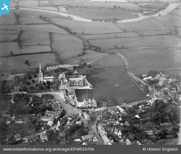
EPW019706 ENGLAND (1927). Repton School, Repton, 1927
© Copyright OpenStreetMap contributors and licensed by the OpenStreetMap Foundation. 2026. Cartography is licensed as CC BY-SA.
Nearby Images (13)
EPW019706

EPW020932

EAW013778

EAW013776

EPW020935

EPW019700

EPW019702

EAW013777

EPW019699

EPW020933

EPW020934

EAW013780

EPW019698

Details
| Title | [EPW019706] Repton School, Repton, 1927 |
| Reference | EPW019706 |
| Date | October-1927 |
| Link | |
| Place name | REPTON |
| Parish | REPTON |
| District | |
| Country | ENGLAND |
| Easting / Northing | 430394, 327244 |
| Longitude / Latitude | -1.5487101368204, 52.841520691226 |
| National Grid Reference | SK304272 |
Pins
Be the first to add a comment to this image!