
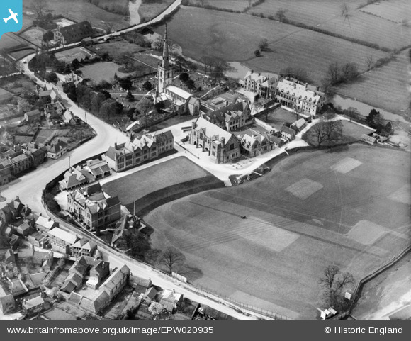
EPW020935 ENGLAND (1928). St Wystan's church and Repton School, Repton, 1928
© Copyright OpenStreetMap contributors and licensed by the OpenStreetMap Foundation. 2026. Cartography is licensed as CC BY-SA.
Nearby Images (15)
EPW020935

EAW013778

EAW013776

EPW019700

EAW013777

EPW019702

EPW020932

EPW019699

EPW019706

EPW020933

EPW020934

EAW013780

EPW019698

EAW013779

EPW019707

Details
| Title | [EPW020935] St Wystan's church and Repton School, Repton, 1928 |
| Reference | EPW020935 |
| Date | April-1928 |
| Link | |
| Place name | REPTON |
| Parish | REPTON |
| District | |
| Country | ENGLAND |
| Easting / Northing | 430381, 327147 |
| Longitude / Latitude | -1.5489121909015, 52.840649377301 |
| National Grid Reference | SK304271 |
Pins

Ian Kitching |
Tuesday 26th of June 2012 07:15:19 AM | |
|
Ian Kitching |
Tuesday 26th of June 2012 07:13:32 AM | |
|
Ian Kitching |
Tuesday 26th of June 2012 07:08:46 AM |