
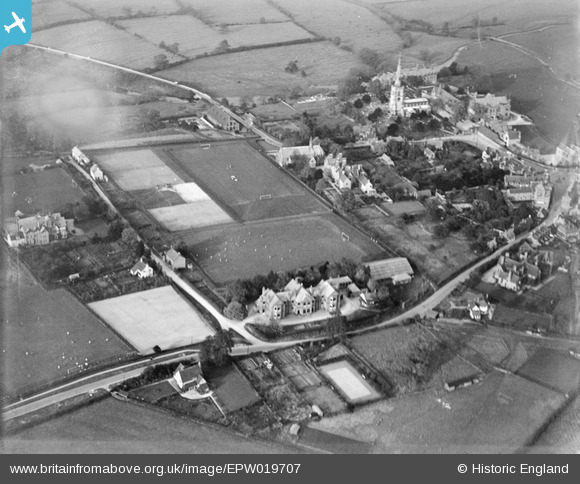
EPW019707 ENGLAND (1927). Repton School and Playing Fields, Repton, 1927
© Copyright OpenStreetMap contributors and licensed by the OpenStreetMap Foundation. 2026. Cartography is licensed as CC BY-SA.
Nearby Images (12)
EPW019707

EPW019703

EPW019698

EAW013780

EPW020934

EPW019699

EPW019701

EPW020933

EPW019705

EAW013777

EAW013776

EPW020935

Details
| Title | [EPW019707] Repton School and Playing Fields, Repton, 1927 |
| Reference | EPW019707 |
| Date | October-1927 |
| Link | |
| Place name | REPTON |
| Parish | REPTON |
| District | |
| Country | ENGLAND |
| Easting / Northing | 430148, 326932 |
| Longitude / Latitude | -1.5523914627252, 52.8387295803 |
| National Grid Reference | SK301269 |
Pins

Giff |
Friday 6th of June 2014 03:19:27 PM | |
|
Giff |
Friday 6th of June 2014 03:18:20 PM | |
|
Giff |
Friday 6th of June 2014 03:16:55 PM | |
|
Giff |
Friday 6th of June 2014 03:09:20 PM | |
|
Giff |
Friday 6th of June 2014 03:08:53 PM |