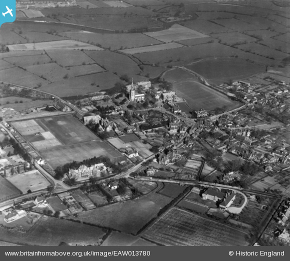
EAW013780 ENGLAND (1948). The village, Repton, 1948. This image has been produced from a print.
© Copyright OpenStreetMap contributors and licensed by the OpenStreetMap Foundation. 2026. Cartography is licensed as CC BY-SA.
Nearby Images (16)
Details
| Title | [EAW013780] The village, Repton, 1948. This image has been produced from a print. |
| Reference | EAW013780 |
| Date | 11-March-1948 |
| Link | |
| Place name | REPTON |
| Parish | REPTON |
| District | |
| Country | ENGLAND |
| Easting / Northing | 430280, 327029 |
| Longitude / Latitude | -1.5504227135638, 52.839594223591 |
| National Grid Reference | SK303270 |
Pins
Be the first to add a comment to this image!


![[EAW013780] The village, Repton, 1948. This image has been produced from a print.](http://britainfromabove.org.uk/sites/all/libraries/aerofilms-images/public/100x100/EAW/013/EAW013780.jpg)
![[EPW020934] The village centre, Repton, 1928](http://britainfromabove.org.uk/sites/all/libraries/aerofilms-images/public/100x100/EPW/020/EPW020934.jpg)
![[EPW019698] Repton School and St Wystan's Church, Repton, 1927](http://britainfromabove.org.uk/sites/all/libraries/aerofilms-images/public/100x100/EPW/019/EPW019698.jpg)
![[EPW019699] Repton School and St Wystan's Church, Repton, 1927](http://britainfromabove.org.uk/sites/all/libraries/aerofilms-images/public/100x100/EPW/019/EPW019699.jpg)
![[EAW013777] Repton School and St Wystan's Church, Repton, 1948. This image has been produced from a print.](http://britainfromabove.org.uk/sites/all/libraries/aerofilms-images/public/100x100/EAW/013/EAW013777.jpg)
![[EPW020933] The Market Cross and environs, Repton, 1928](http://britainfromabove.org.uk/sites/all/libraries/aerofilms-images/public/100x100/EPW/020/EPW020933.jpg)
![[EPW020935] St Wystan's church and Repton School, Repton, 1928](http://britainfromabove.org.uk/sites/all/libraries/aerofilms-images/public/100x100/EPW/020/EPW020935.jpg)
![[EPW019707] Repton School and Playing Fields, Repton, 1927](http://britainfromabove.org.uk/sites/all/libraries/aerofilms-images/public/100x100/EPW/019/EPW019707.jpg)
![[EAW013776] Repton School and St Wystan's Church, Repton, 1948. This image has been produced from a damaged negative.](http://britainfromabove.org.uk/sites/all/libraries/aerofilms-images/public/100x100/EAW/013/EAW013776.jpg)
![[EAW013779] The village, Repton, 1948. This image has been produced from a print.](http://britainfromabove.org.uk/sites/all/libraries/aerofilms-images/public/100x100/EAW/013/EAW013779.jpg)
![[EPW019703] Repton School Playing Fields, Repton, 1927](http://britainfromabove.org.uk/sites/all/libraries/aerofilms-images/public/100x100/EPW/019/EPW019703.jpg)
![[EPW019702] Repton School, Repton, 1927](http://britainfromabove.org.uk/sites/all/libraries/aerofilms-images/public/100x100/EPW/019/EPW019702.jpg)
![[EAW013778] Repton School and St Wystan's Church, Repton, 1948. This image has been produced from a print.](http://britainfromabove.org.uk/sites/all/libraries/aerofilms-images/public/100x100/EAW/013/EAW013778.jpg)
![[EPW019700] Repton School and St Wystan's Church, Repton, 1927](http://britainfromabove.org.uk/sites/all/libraries/aerofilms-images/public/100x100/EPW/019/EPW019700.jpg)
![[EPW020932] St Wystan's Church and Repton School, Repton, 1928](http://britainfromabove.org.uk/sites/all/libraries/aerofilms-images/public/100x100/EPW/020/EPW020932.jpg)
![[EPW019706] Repton School, Repton, 1927](http://britainfromabove.org.uk/sites/all/libraries/aerofilms-images/public/100x100/EPW/019/EPW019706.jpg)