
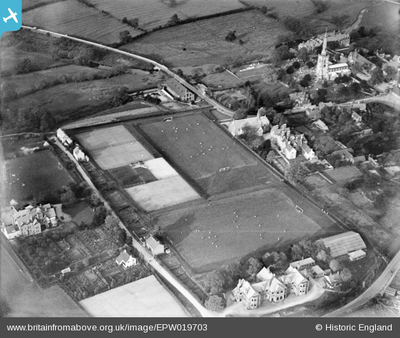
EPW019703 ENGLAND (1927). Repton School Playing Fields, Repton, 1927
© Copyright OpenStreetMap contributors and licensed by the OpenStreetMap Foundation. 2026. Cartography is licensed as CC BY-SA.
Nearby Images (10)
EPW019703

EPW019698

EPW019707

EAW013780

EPW019699

EPW020934

EAW013777

EPW019701

EPW019704

EAW013776

Details
| Title | [EPW019703] Repton School Playing Fields, Repton, 1927 |
| Reference | EPW019703 |
| Date | October-1927 |
| Link | |
| Place name | REPTON |
| Parish | REPTON |
| District | |
| Country | ENGLAND |
| Easting / Northing | 430103, 327039 |
| Longitude / Latitude | -1.5530496812755, 52.839694047276 |
| National Grid Reference | SK301270 |
Pins
Be the first to add a comment to this image!