
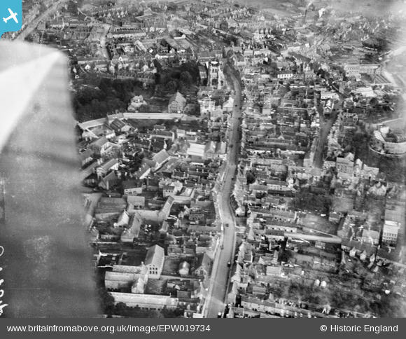
EPW019734 ENGLAND (1927). St Editha's Church and Church Street, Tamworth, 1927
© Copyright OpenStreetMap contributors and licensed by the OpenStreetMap Foundation. 2026. Cartography is licensed as CC BY-SA.
Nearby Images (17)
EPW019734

EPW019733

EAW003618

EAW007511

EPW019732

EAW003617

EAW007512

EPW019731

EAW007508

EAW007509

EPW024630

EPW024636

EPW024637

EAW007510

EAW003616

EAW007514

EAW007513

Details
| Title | [EPW019734] St Editha's Church and Church Street, Tamworth, 1927 |
| Reference | EPW019734 |
| Date | 20-October-1927 |
| Link | |
| Place name | TAMWORTH |
| Parish | |
| District | |
| Country | ENGLAND |
| Easting / Northing | 420583, 304084 |
| Longitude / Latitude | -1.6958338993378, 52.63376531948 |
| National Grid Reference | SK206041 |
Pins

Andrew Sandars |
Friday 3rd of April 2015 06:51:40 PM | |
|
Andrew Sandars |
Sunday 15th of February 2015 03:42:37 PM | |
|
EMC |
Saturday 17th of August 2013 03:19:38 PM | |
|
Chris Gibson |
Wednesday 10th of October 2012 03:03:34 PM | |
|
Angella |
Monday 30th of July 2012 08:49:44 PM | |
|
Angella |
Monday 30th of July 2012 08:49:24 PM |
