
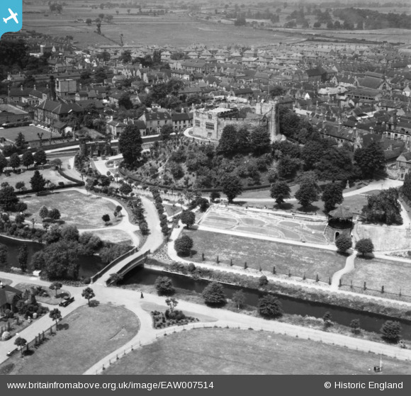
EAW007514 ENGLAND (1947). Tamworth Castle and environs, Tamworth, 1947. This image has been produced from a print.
© Copyright OpenStreetMap contributors and licensed by the OpenStreetMap Foundation. 2026. Cartography is licensed as CC BY-SA.
Nearby Images (18)
EAW007514

EAW007510

EAW007512

EAW003616

EAW007509

EAW003617

EPW019732

EPW019731

EAW007508

EPW024630

EAW007511

EAW003618

EPW024634

EAW007513

EPW019733

EPW024637

EPW019734

EPW024636

Details
| Title | [EAW007514] Tamworth Castle and environs, Tamworth, 1947. This image has been produced from a print. |
| Reference | EAW007514 |
| Date | 3-June-1947 |
| Link | |
| Place name | TAMWORTH |
| Parish | |
| District | |
| Country | ENGLAND |
| Easting / Northing | 420641, 303887 |
| Longitude / Latitude | -1.6949891319818, 52.631991958681 |
| National Grid Reference | SK206039 |
Pins

redmist |
Thursday 25th of March 2021 10:25:23 AM | |
|
Toby Clempson |
Wednesday 3rd of September 2014 07:25:02 AM |