
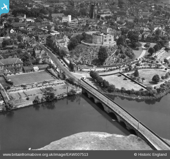
EAW007513 ENGLAND (1947). Lady Bridge and Tamworth Castle, Tamworth, 1947. This image has been produced from a print.
© Copyright OpenStreetMap contributors and licensed by the OpenStreetMap Foundation. 2026. Cartography is licensed as CC BY-SA.
Nearby Images (18)
EAW007513

EPW024630

EPW024634

EAW007508

EPW019731

EAW007511

EPW019732

EAW007509

EAW003617

EAW007512

EAW007514

EAW007510

EAW003618

EAW003616

EPW019733

EPW024637

EPW019734

EPW024636

Details
| Title | [EAW007513] Lady Bridge and Tamworth Castle, Tamworth, 1947. This image has been produced from a print. |
| Reference | EAW007513 |
| Date | 3-June-1947 |
| Link | |
| Place name | TAMWORTH |
| Parish | |
| District | |
| Country | ENGLAND |
| Easting / Northing | 420553, 303865 |
| Longitude / Latitude | -1.6962908525183, 52.63179750461 |
| National Grid Reference | SK206039 |
Pins

redmist |
Thursday 25th of March 2021 10:28:36 AM | |
|
redmist |
Thursday 25th of March 2021 10:23:07 AM | |
|
redmist |
Thursday 25th of March 2021 10:22:36 AM | |
|
Andrew Sandars |
Tuesday 13th of January 2015 08:07:06 PM |