
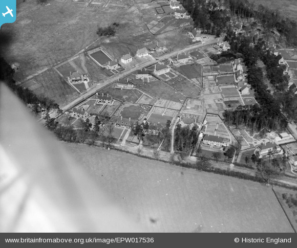
EPW017536 ENGLAND (1927). New housing at Pinnerhill Farm, Pinner, 1927
© Copyright OpenStreetMap contributors and licensed by the OpenStreetMap Foundation. 2025. Cartography is licensed as CC BY-SA.
Nearby Images (9)
EPW017536

EPW017532

EPW017528

EPW017530

EPW017533

EPW017531

EPW017535

EPW017529

EPW017534

Details
| Title | [EPW017536] New housing at Pinnerhill Farm, Pinner, 1927 |
| Reference | EPW017536 |
| Date | March-1927 |
| Link | |
| Place name | PINNER |
| Parish | |
| District | |
| Country | ENGLAND |
| Easting / Northing | 510874, 190958 |
| Longitude / Latitude | -0.39876516480077, 51.6060573713 |
| National Grid Reference | TQ109910 |
