
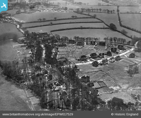
EPW017529 ENGLAND (1927). New housing at Pinnerhill Farm, Pinner, 1927
© Copyright OpenStreetMap contributors and licensed by the OpenStreetMap Foundation. 2024. Cartography is licensed as CC BY-SA.
Nearby Images (9)
EPW017529

EPW017535

EPW017530

EPW017533

EPW017536

EPW017534

EPW017532

EPW017528

EPW017531

Details
| Title | [EPW017529] New housing at Pinnerhill Farm, Pinner, 1927 |
| Reference | EPW017529 |
| Date | March-1927 |
| Link | |
| Place name | PINNER |
| Parish | |
| District | |
| Country | ENGLAND |
| Easting / Northing | 510959, 191031 |
| Longitude / Latitude | -0.39751501079955, 51.606696809187 |
| National Grid Reference | TQ110910 |
Pins
Be the first to add a comment to this image!
User Comment Contributions
The same area of estate but taken from the north and slightly higher up the hill. Eastcote Road and Pinner Green top left. |
 Harrow&Wembley |
Tuesday 3rd of July 2012 10:59:13 PM |