
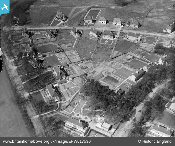
EPW017530 ENGLAND (1927). New housing at Pinnerhill Farm, Pinner, 1927
© Copyright OpenStreetMap contributors and licensed by the OpenStreetMap Foundation. 2024. Cartography is licensed as CC BY-SA.
Nearby Images (9)
EPW017530

EPW017535

EPW017536

EPW017528

EPW017532

EPW017529

EPW017533

EPW017531

EPW017534

Details
| Title | [EPW017530] New housing at Pinnerhill Farm, Pinner, 1927 |
| Reference | EPW017530 |
| Date | March-1927 |
| Link | |
| Place name | PINNER |
| Parish | |
| District | |
| Country | ENGLAND |
| Easting / Northing | 510929, 190963 |
| Longitude / Latitude | -0.39796961058135, 51.606091481104 |
| National Grid Reference | TQ109910 |
Pins
Be the first to add a comment to this image!
User Comment Contributions
Hillside Road runs across the top of the photo. Top left Monks Rest is hidden. Like Pond Cottage it was a transplant via the Daily Mail Ideal Home Exhibitions of 1924 and 1926. |
 Harrow&Wembley |
Tuesday 3rd of July 2012 10:58:41 PM |