
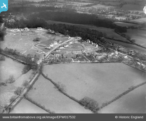
EPW017532 ENGLAND (1927). New housing at Pinnerhill Farm, Pinner, 1927
© Copyright OpenStreetMap contributors and licensed by the OpenStreetMap Foundation. 2024. Cartography is licensed as CC BY-SA.
Nearby Images (9)
EPW017532

EPW017536

EPW017528

EPW017530

EPW017531

EPW017533

EPW017535

EPW017529

EPW017534

Details
| Title | [EPW017532] New housing at Pinnerhill Farm, Pinner, 1927 |
| Reference | EPW017532 |
| Date | March-1927 |
| Link | |
| Place name | PINNER |
| Parish | |
| District | |
| Country | ENGLAND |
| Easting / Northing | 510861, 190939 |
| Longitude / Latitude | -0.39895883956892, 51.605889143581 |
| National Grid Reference | TQ109909 |
Pins
User Comment Contributions
View looking north. |
 Class31 |
Tuesday 18th of September 2012 11:02:54 AM |