
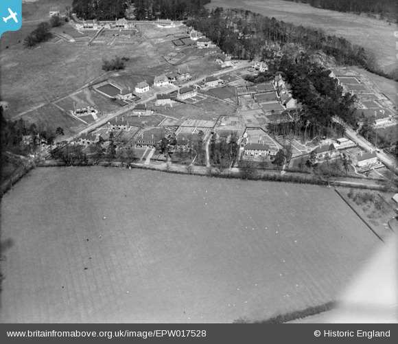
EPW017528 ENGLAND (1927). New housing at Pinnerhill Farm, Pinner, 1927
© Copyright OpenStreetMap contributors and licensed by the OpenStreetMap Foundation. 2024. Cartography is licensed as CC BY-SA.
Nearby Images (9)
EPW017528

EPW017532

EPW017536

EPW017530

EPW017533

EPW017531

EPW017535

EPW017529

EPW017534

Details
| Title | [EPW017528] New housing at Pinnerhill Farm, Pinner, 1927 |
| Reference | EPW017528 |
| Date | March-1927 |
| Link | |
| Place name | PINNER |
| Parish | |
| District | |
| Country | ENGLAND |
| Easting / Northing | 510883, 190913 |
| Longitude / Latitude | -0.39864947563604, 51.60565110147 |
| National Grid Reference | TQ109909 |
Pins
Be the first to add a comment to this image!
User Comment Contributions
Top right is the westerly extent of Pinner Hill Wood, before the creation of the golf course took away about half of it. The approx. 9 acres remaining are designated Ancient Woodland. That means it has never been anything else. The slopes preclude any reasonable farming, and much of those are almost directly on to gravel. |
 Harrow&Wembley |
Wednesday 4th of July 2012 03:44:35 PM |