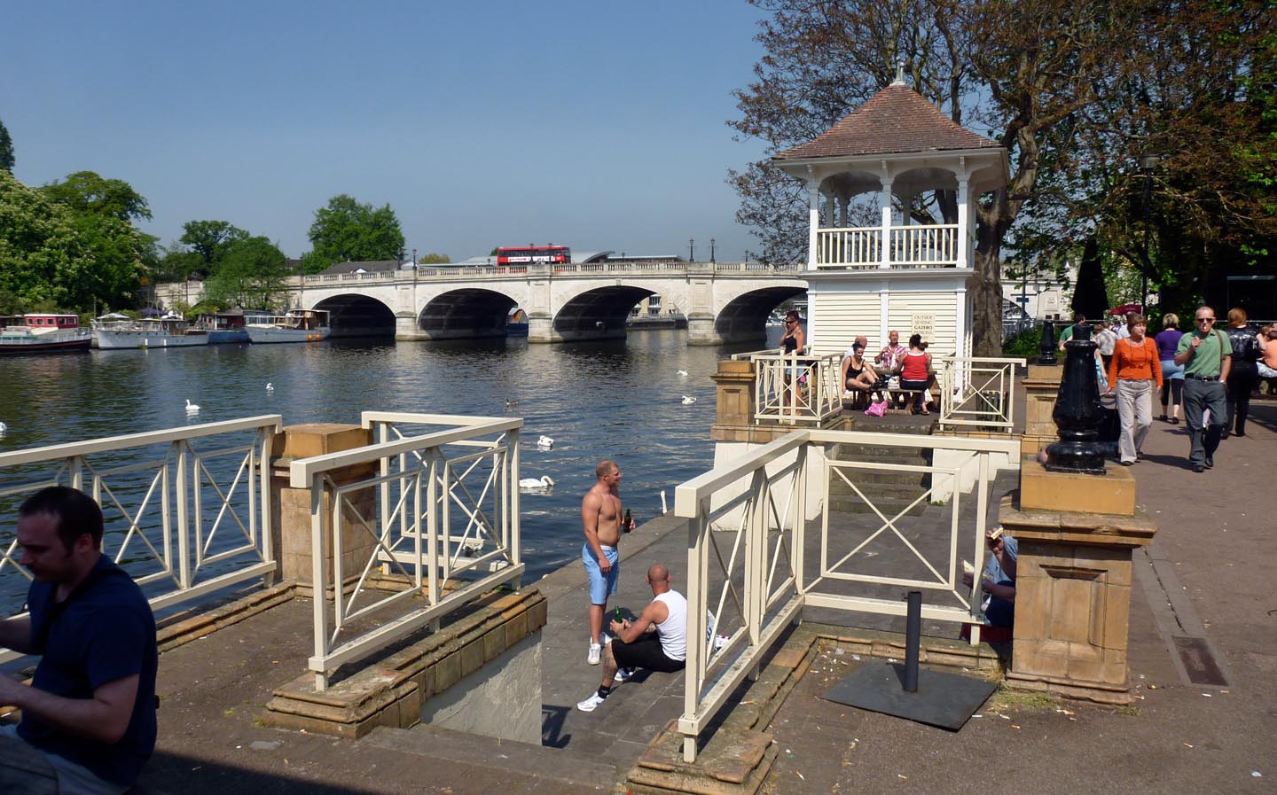
EPW008868 ENGLAND (1923). The riverside south of Kingston Bridge, Kingston upon Thames, 1923
© Copyright OpenStreetMap contributors and licensed by the OpenStreetMap Foundation. 2026. Cartography is licensed as CC BY-SA.
Nearby Images (21)
Details
| Title | [EPW008868] The riverside south of Kingston Bridge, Kingston upon Thames, 1923 |
| Reference | EPW008868 |
| Date | July-1923 |
| Link | |
| Place name | KINGSTON UPON THAMES |
| Parish | |
| District | |
| Country | ENGLAND |
| Easting / Northing | 517733, 169189 |
| Longitude / Latitude | -0.30702277621379, 51.408993073541 |
| National Grid Reference | TQ177692 |
Pins

UPONTHAMES |
Monday 8th of August 2022 10:04:06 PM | |

UPONTHAMES |
Monday 8th of August 2022 09:54:19 PM | |

Leslie B |
Sunday 27th of March 2016 06:30:38 PM | |

Pip |
Thursday 2nd of January 2014 01:13:54 AM | |

Pip |
Thursday 2nd of January 2014 01:12:14 AM |
User Comment Contributions

Kingston Bridge |

Alan McFaden |
Tuesday 25th of November 2014 04:40:31 PM |

Kingston upon Thames |

Alan McFaden |
Tuesday 25th of November 2014 04:40:04 PM |


![[EPW008868] The riverside south of Kingston Bridge, Kingston upon Thames, 1923](http://britainfromabove.org.uk/sites/all/libraries/aerofilms-images/public/100x100/EPW/008/EPW008868.jpg)
![[EPW008869] The riverside south of Kingston Bridge, Kingston upon Thames, 1923](http://britainfromabove.org.uk/sites/all/libraries/aerofilms-images/public/100x100/EPW/008/EPW008869.jpg)
![[EPW011000] The town and the River Thames, Kingston upon Thames, from the south, 1924. This image has been produced from a copy-negative.](http://britainfromabove.org.uk/sites/all/libraries/aerofilms-images/public/100x100/EPW/011/EPW011000.jpg)
![[EAW042764] All Saints' Church and the Market Place, Kingston Upon Thames, 1952](http://britainfromabove.org.uk/sites/all/libraries/aerofilms-images/public/100x100/EAW/042/EAW042764.jpg)
![[EAW042765] All Saints' Church and the Market Place, Kingston Upon Thames, 1952](http://britainfromabove.org.uk/sites/all/libraries/aerofilms-images/public/100x100/EAW/042/EAW042765.jpg)
![[EPW022858] Kingston Bridge, Kingston upon Thames, 1928](http://britainfromabove.org.uk/sites/all/libraries/aerofilms-images/public/100x100/EPW/022/EPW022858.jpg)
![[EPW022855] Kingston Bridge and the town, Kingston upon Thames, 1928](http://britainfromabove.org.uk/sites/all/libraries/aerofilms-images/public/100x100/EPW/022/EPW022855.jpg)
![[EPW010999] The town and the River Thames, Kingston upon Thames, from the south, 1924. This image has been produced from a copy-negative.](http://britainfromabove.org.uk/sites/all/libraries/aerofilms-images/public/100x100/EPW/010/EPW010999.jpg)
![[EAW008244] Kingston Bridge, Kingston Upon Thames, 1947](http://britainfromabove.org.uk/sites/all/libraries/aerofilms-images/public/100x100/EAW/008/EAW008244.jpg)
![[EPW018089] Kingston Bridge and the River Thames, Kingston upon Thames, from the south-east, 1927](http://britainfromabove.org.uk/sites/all/libraries/aerofilms-images/public/100x100/EPW/018/EPW018089.jpg)
![[EPW001723] Kingston upon Thames and Kingston Bridges, Kingston upon Thames, 1920](http://britainfromabove.org.uk/sites/all/libraries/aerofilms-images/public/100x100/EPW/001/EPW001723.jpg)
![[EPW011002] All Saints' Church, Kingston Bridge and environs, Kingston Upon Thames, 1924. This image has been produced from a print.](http://britainfromabove.org.uk/sites/all/libraries/aerofilms-images/public/100x100/EPW/011/EPW011002.jpg)
![[EPR000681] The Guildhall and environs, Kingston Upon Thames, 1935](http://britainfromabove.org.uk/sites/all/libraries/aerofilms-images/public/100x100/EPR/000/EPR000681.jpg)
![[EPW022856] Kingston Bridge and the riverside, Kingston upon Thames, 1928](http://britainfromabove.org.uk/sites/all/libraries/aerofilms-images/public/100x100/EPW/022/EPW022856.jpg)
![[EPR000680] The Guildhall, Kingston Upon Thames, 1935](http://britainfromabove.org.uk/sites/all/libraries/aerofilms-images/public/100x100/EPR/000/EPR000680.jpg)
![[EAW042763] Kingston Bridge and environs, Kingston Upon Thames, 1952](http://britainfromabove.org.uk/sites/all/libraries/aerofilms-images/public/100x100/EAW/042/EAW042763.jpg)
![[EPR000682] Clarence Street and environs including Bentall's Department Store and All Saints' Church, Kingston Upon Thames, 1935](http://britainfromabove.org.uk/sites/all/libraries/aerofilms-images/public/100x100/EPR/000/EPR000682.jpg)
![[EPW001722] Kingston Bridge, Kingston upon Thames, 1920](http://britainfromabove.org.uk/sites/all/libraries/aerofilms-images/public/100x100/EPW/001/EPW001722.jpg)
![[EPW001721] Kingston Bridge and Railway Bridge, Kingston upon Thames, 1920](http://britainfromabove.org.uk/sites/all/libraries/aerofilms-images/public/100x100/EPW/001/EPW001721.jpg)
![[EPW001724] Kingston upon Thames and Kingston Bridges, Kingston upon Thames, 1920](http://britainfromabove.org.uk/sites/all/libraries/aerofilms-images/public/100x100/EPW/001/EPW001724.jpg)
![[EPW018087] Kingston Bridge and the High Street, Hampton Wick, 1927](http://britainfromabove.org.uk/sites/all/libraries/aerofilms-images/public/100x100/EPW/018/EPW018087.jpg)