
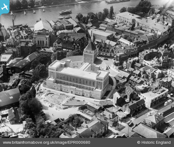
EPR000680 ENGLAND (1935). The Guildhall, Kingston Upon Thames, 1935
© Copyright OpenStreetMap contributors and licensed by the OpenStreetMap Foundation. 2026. Cartography is licensed as CC BY-SA.
Nearby Images (10)
EPR000680

EPR000681

EPW010999

EPW018089

EPW011000

EAW042765

EAW042764

EPW008869

EPW008868

EPW011002

Details
| Title | [EPR000680] The Guildhall, Kingston Upon Thames, 1935 |
| Reference | EPR000680 |
| Date | 22-June-1935 |
| Link | |
| Place name | KINGSTON UPON THAMES |
| Parish | |
| District | |
| Country | ENGLAND |
| Easting / Northing | 517910, 169076 |
| Longitude / Latitude | -0.30451632441245, 51.407940566698 |
| National Grid Reference | TQ179691 |
Pins
Be the first to add a comment to this image!