
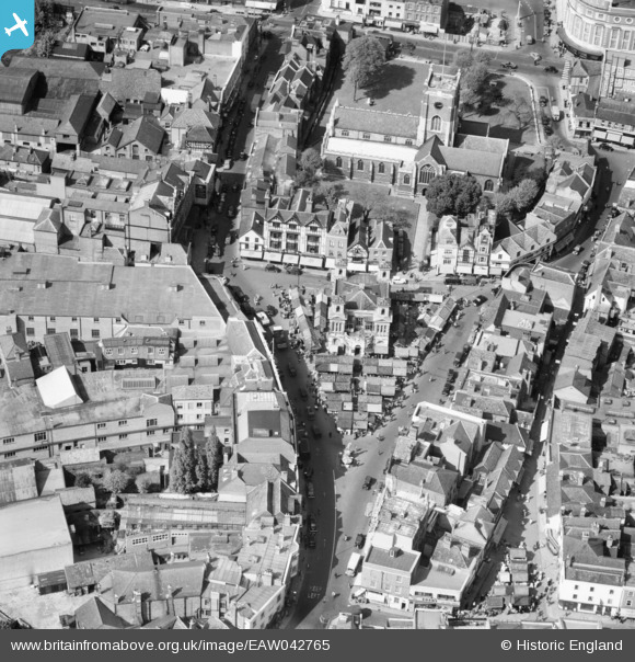
EAW042765 ENGLAND (1952). All Saints' Church and the Market Place, Kingston Upon Thames, 1952
© Copyright OpenStreetMap contributors and licensed by the OpenStreetMap Foundation. 2026. Cartography is licensed as CC BY-SA.
Nearby Images (19)
EAW042765

EAW042764

EPW011002

EPR000682

EPR000681

EPR000680

EPW010999

EPW008868

EPW018089

EPW022855

EPW011000

EPW008869

EPW022856

EPW022858

EAW008244

EAW042763

EAW022048

EAW042766

EAW042762

Details
| Title | [EAW042765] All Saints' Church and the Market Place, Kingston Upon Thames, 1952 |
| Reference | EAW042765 |
| Date | 29-April-1952 |
| Link | |
| Place name | KINGSTON UPON THAMES |
| Parish | |
| District | |
| Country | ENGLAND |
| Easting / Northing | 517885, 169229 |
| Longitude / Latitude | -0.30482477449354, 51.409321037522 |
| National Grid Reference | TQ179692 |
Pins
Be the first to add a comment to this image!