
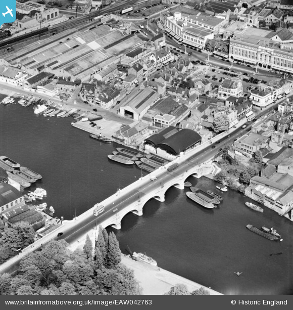
EAW042763 ENGLAND (1952). Kingston Bridge and environs, Kingston Upon Thames, 1952
© Copyright OpenStreetMap contributors and licensed by the OpenStreetMap Foundation. 2026. Cartography is licensed as CC BY-SA.
Nearby Images (18)
EAW042763

EPW022856

EPW022855

EAW042762

EAW008244

EPW022858

EPW011002

EPR000682

EPW001723

EPW001721

EPW001722

EPW001726

EAW042764

EAW022048

EAW042765

EPW018087

EPW008868

EPW001724

Details
| Title | [EAW042763] Kingston Bridge and environs, Kingston Upon Thames, 1952 |
| Reference | EAW042763 |
| Date | 29-April-1952 |
| Link | |
| Place name | KINGSTON UPON THAMES |
| Parish | |
| District | |
| Country | ENGLAND |
| Easting / Northing | 517770, 169412 |
| Longitude / Latitude | -0.30641689932049, 51.410989872091 |
| National Grid Reference | TQ178694 |
Pins

UPONTHAMES |
Sunday 11th of August 2024 09:24:18 PM | |
|
UPONTHAMES |
Sunday 11th of August 2024 09:21:33 PM | |
|
UPONTHAMES |
Sunday 11th of August 2024 09:12:41 PM | |
|
UPONTHAMES |
Sunday 11th of August 2024 09:06:54 PM | |

Sparky |
Sunday 29th of October 2017 01:47:05 AM |