
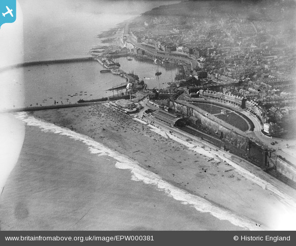
EPW000381 ENGLAND (1920). Ramsgate Harbour, Kent, from the north-east, 1920
© Copyright OpenStreetMap contributors and licensed by the OpenStreetMap Foundation. 2026. Cartography is licensed as CC BY-SA.
Nearby Images (47)
EPW000381

EAW009016

EAW009053

EPW039394

EAW006167

EAW009017

EAW017590

EAW009063

EAW009005

EAW009052

EPW009175

EAW009004

EAW009015

EPW039395

EAW009003

EAW017591

EAW009054

EPW000599

EPW000702

EPW042859

EAW024844

EAW009014

EAW024842

EAW006168

EPW009174

EPW018649

EAW006170

EAW006171

EPW035446

EAW006166

EAW009058

EAW009056

EPW035453

EPW009173

EAW006169

EPW000093

EPW035450

EAW009057

EPW039325

EPW009172

EPW000087

EAW009055

EPW042861

EAW024843

EAW009051

EPW039324

EPW042864

Details
| Title | [EPW000381] Ramsgate Harbour, Kent, from the north-east, 1920 |
| Reference | EPW000381 |
| Date | April-1920 |
| Link | |
| Place name | RAMSGATE |
| Parish | RAMSGATE |
| District | |
| Country | ENGLAND |
| Easting / Northing | 638837, 164903 |
| Longitude / Latitude | 1.4290461407464, 51.33246952532 |
| National Grid Reference | TR388649 |
Pins

Alan McFaden |
Thursday 11th of December 2014 10:51:45 AM | |
|
Alan McFaden |
Thursday 11th of December 2014 10:51:07 AM | |
|
Alan McFaden |
Thursday 11th of December 2014 10:50:31 AM | |
|
Alan McFaden |
Thursday 11th of December 2014 10:50:04 AM |


User Comment Contributions
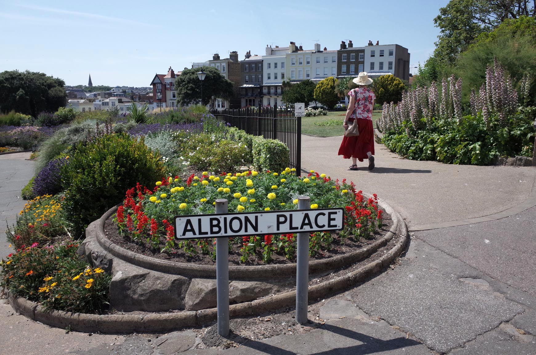
Albion Place Gardens |
Alan McFaden |
Thursday 11th of December 2014 10:52:27 AM |