
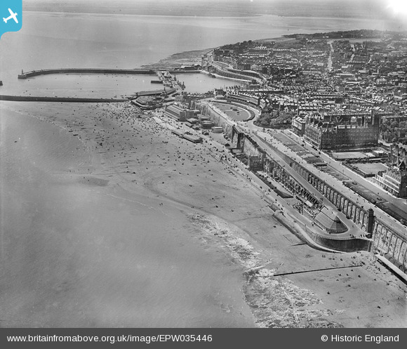
EPW035446 ENGLAND (1931). Ramsgate Sands, the Royal Harbour and environs, Ramsgate, 1931
© Copyright OpenStreetMap contributors and licensed by the OpenStreetMap Foundation. 2026. Cartography is licensed as CC BY-SA.
Nearby Images (29)
EPW035446

EPW000702

EAW009003

EPW039395

EPW035447

EAW009063

EAW017590

EPW052886

EAW009017

EPW000597

EAW009005

EPW000381

EPW039394

EAW009053

EAW009016

EPW000698

EPW000373

EPW039323

EAW009052

EAW009015

EPW000599

EAW006168

EAW006170

EAW006171

EAW024844

EAW009014

EAW006166

EAW009058

EAW009056

Details
| Title | [EPW035446] Ramsgate Sands, the Royal Harbour and environs, Ramsgate, 1931 |
| Reference | EPW035446 |
| Date | May-1931 |
| Link | |
| Place name | RAMSGATE |
| Parish | RAMSGATE |
| District | |
| Country | ENGLAND |
| Easting / Northing | 638886, 165089 |
| Longitude / Latitude | 1.4298730208482, 51.334118599694 |
| National Grid Reference | TR389651 |
Pins

gBr |
Sunday 14th of July 2019 08:43:07 PM | |
|
Gen_Hancock |
Thursday 9th of February 2017 02:16:46 PM | |

Alan McFaden |
Monday 13th of October 2014 10:00:57 AM | |
|
Alan McFaden |
Monday 13th of October 2014 10:00:10 AM | |
|
Alan McFaden |
Monday 13th of October 2014 09:59:33 AM | |
|
Alan McFaden |
Monday 13th of October 2014 09:58:58 AM |


