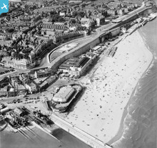
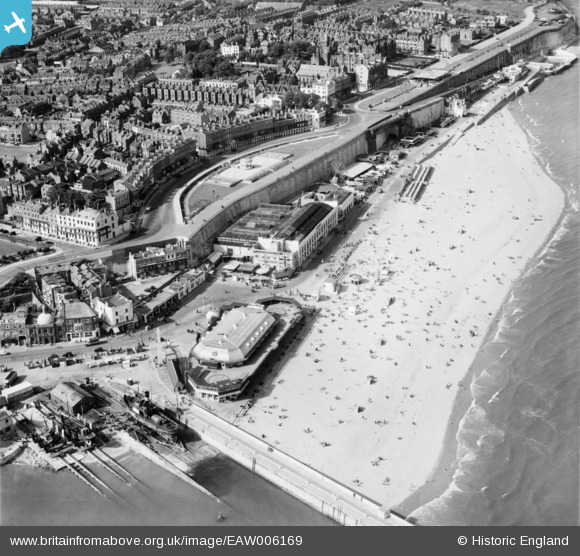
EAW006169 ENGLAND (1947). Ramsgate Sands, Wellington Crescent and environs, Ramsgate, 1947
© Copyright OpenStreetMap contributors and licensed by the OpenStreetMap Foundation. 2026. Cartography is licensed as CC BY-SA.
Nearby Images (48)
EAW006169

EAW009056

EAW009058

EPW000093

EAW006166

EPW035453

EPW009173

EPW039325

EAW006170

EAW009014

EAW024844

EAW009057

EPW000087

EAW006171

EAW024842

EPW009172

EPW048783

EPW000599

EAW006168

EPW039324

EAW024843

EPW042859

EPW035450

EAW009051

EPW009174

EAW009049

EAW009015

EAW009052

EAW009054

EAW017591

EPW009175

EPW018649

EPW000096

EPW042864

EAW006167

EPW042861

EPW039394

EAW009005

EPW000092

EPW039353

EAW009055

EAW017590

EPW000596

EPW000604

EAW006164

EAW006165

EPW035449

EAW015836

Details
| Title | [EAW006169] Ramsgate Sands, Wellington Crescent and environs, Ramsgate, 1947 |
| Reference | EAW006169 |
| Date | 27-May-1947 |
| Link | |
| Place name | RAMSGATE |
| Parish | RAMSGATE |
| District | |
| Country | ENGLAND |
| Easting / Northing | 638639, 164836 |
| Longitude / Latitude | 1.4261639813583, 51.331951207537 |
| National Grid Reference | TR386648 |
Pins

Matt Aldred edob.mattaldred.com |
Thursday 11th of March 2021 11:15:54 PM | |
 |

John W |
Friday 7th of October 2016 09:36:23 PM |

Alan McFaden |
Saturday 12th of July 2014 12:27:28 PM | |
|
Alan McFaden |
Saturday 12th of July 2014 12:26:54 PM | |
|
Alan McFaden |
Saturday 12th of July 2014 12:26:14 PM | |
|
Alan McFaden |
Saturday 12th of July 2014 12:25:47 PM | |
|
Alan McFaden |
Saturday 12th of July 2014 12:25:16 PM | |
|
cptpies |
Friday 9th of May 2014 03:24:41 PM | |
|
cptpies |
Friday 9th of May 2014 03:24:13 PM |