
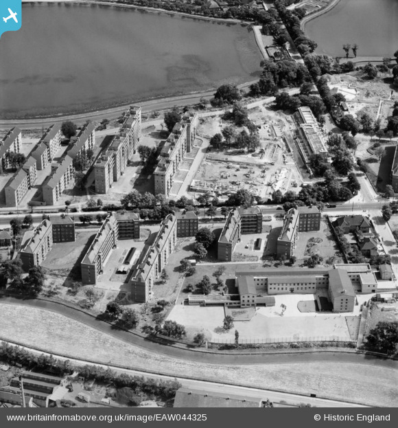
EAW044325 ENGLAND (1952). The Woodberry Down Estate between New River and East Reservoir, Stamford Hill, 1952
© Copyright OpenStreetMap contributors and licensed by the OpenStreetMap Foundation. 2026. Cartography is licensed as CC BY-SA.
Nearby Images (26)
EAW044325

EAW044314

EAW044318

EAW044316

EAW044315

EAW044311

EAW044321

EAW044312

EAW044327

EAW044322

EAW044320

EAW044317

EAW044326

EAW044324

EPW007024

EAW035115

EAW035109

EPW007020

EAW035118

EAW028535
 on Eade Road, Tottenham, 1950. This image was marked by Aerofilms Ltd for photo editing.")
EPW007025

EAW035119

EPW007023

EAW035110

EAW035117

EAW035111

Details
| Title | [EAW044325] The Woodberry Down Estate between New River and East Reservoir, Stamford Hill, 1952 |
| Reference | EAW044325 |
| Date | 24-June-1952 |
| Link | |
| Place name | STAMFORD HILL |
| Parish | |
| District | |
| Country | ENGLAND |
| Easting / Northing | 532522, 187739 |
| Longitude / Latitude | -0.087514143174707, 51.572448022763 |
| National Grid Reference | TQ325877 |
Pins
Be the first to add a comment to this image!