
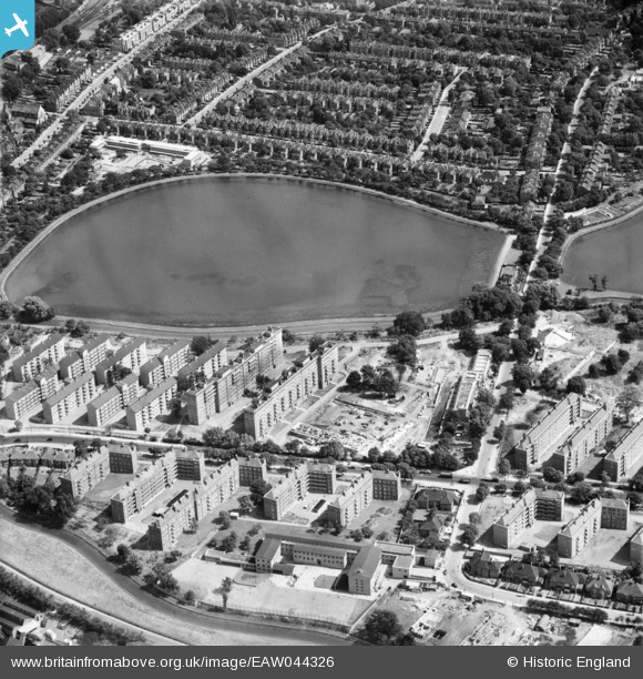
EAW044326 ENGLAND (1952). The Woodberry Down Estate between New River and East Reservoir, Stamford Hill, 1952
© Copyright OpenStreetMap contributors and licensed by the OpenStreetMap Foundation. 2026. Cartography is licensed as CC BY-SA.
Nearby Images (12)
EAW044326

EAW044316

EAW044311

EAW044327

EAW044322

EAW044321

EAW044325

EAW044318

EAW044315

EAW044314

EAW044320

EAW044312

Details
| Title | [EAW044326] The Woodberry Down Estate between New River and East Reservoir, Stamford Hill, 1952 |
| Reference | EAW044326 |
| Date | 24-June-1952 |
| Link | |
| Place name | STAMFORD HILL |
| Parish | |
| District | |
| Country | ENGLAND |
| Easting / Northing | 532640, 187598 |
| Longitude / Latitude | -0.085865495766593, 51.571153048994 |
| National Grid Reference | TQ326876 |
Pins

A Schreiber |
Monday 11th of April 2016 11:34:45 AM |