
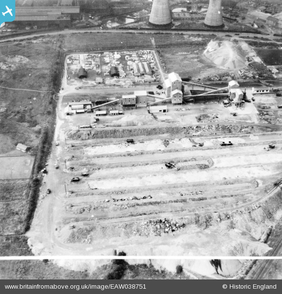
EAW038751 ENGLAND (1951). Part of the John Lysaght Ltd Normanby Park Steel Works, Scunthorpe, 1951. This image has been produced from a print marked by Aerofilms Ltd for photo editing.
© Copyright OpenStreetMap contributors and licensed by the OpenStreetMap Foundation. 2026. Cartography is licensed as CC BY-SA.
Nearby Images (39)
EAW038751

EAW038750

EAW028581

EAW038752

EAW031181

EAW034823

EAW034819

EAW031182

EAW028578

EAW027182

EAW013487

EAW021139

EAW034822

EAW019675

EAW027183

EAW034818

EAW023926

EAW027184

EPW048946

EAW021138

EAW031183

EAW023925

EAW021136

EAW034821

EAW019676

EAW034828

EAW021137

EAW019673

EAW027178

EAW013488

EPW048948

EPW048950

EAW009626

EAW021132

EAW019669

EAW049671

EAW038771

EPW048526

EAW038746

Details
| Title | [EAW038751] Part of the John Lysaght Ltd Normanby Park Steel Works, Scunthorpe, 1951. This image has been produced from a print marked by Aerofilms Ltd for photo editing. |
| Reference | EAW038751 |
| Date | 15-August-1951 |
| Link | |
| Place name | SCUNTHORPE |
| Parish | |
| District | |
| Country | ENGLAND |
| Easting / Northing | 489138, 414174 |
| Longitude / Latitude | -0.65233797077802, 53.616280145179 |
| National Grid Reference | SE891142 |
Pins
Be the first to add a comment to this image!