
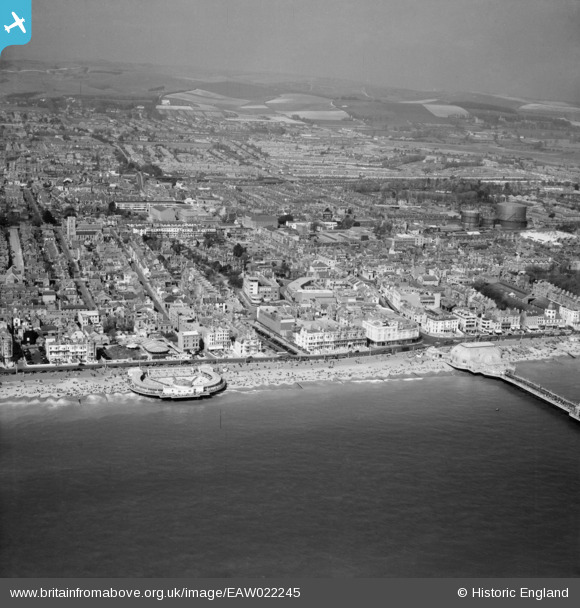
EAW022245 ENGLAND (1949). The Bandstand (The Lido) and the town, Worthing, from the south, 1949
© Copyright OpenStreetMap contributors and licensed by the OpenStreetMap Foundation. 2026. Cartography is licensed as CC BY-SA.
Nearby Images (31)
EAW022245
 and the town, Worthing, from the south, 1949")
EAW053164

EPW018752

EAW022748

EPW000725

EPW039493

EAW053165

EPW011532

EPW045567

EPW017743

EPW017741

EPW042999

EPW017739

EPW000761

EPW054071

EPW039496

EPW000749

EAW022244

EPW000753

EAW022745

EAW022242

EPW011535

EPW039494

EPW011524

EPW018751

EPW000719

EPW042995

EAW053163

EPW042998

EPW017740

EPW018750

Details
| Title | [EAW022245] The Bandstand (The Lido) and the town, Worthing, from the south, 1949 |
| Reference | EAW022245 |
| Date | 17-April-1949 |
| Link | |
| Place name | WORTHING |
| Parish | |
| District | |
| Country | ENGLAND |
| Easting / Northing | 514824, 102257 |
| Longitude / Latitude | -0.37014132007992, 50.807909861653 |
| National Grid Reference | TQ148023 |
Pins

Bekd |
Wednesday 9th of October 2024 01:31:31 PM | |

Alan McFaden |
Wednesday 1st of January 2014 11:22:15 PM | |
|
Alan McFaden |
Wednesday 1st of January 2014 03:40:33 PM | |
|
Alan McFaden |
Tuesday 24th of December 2013 09:53:33 PM | |
|
Alan McFaden |
Tuesday 24th of December 2013 09:53:09 PM | |
|
Alan McFaden |
Tuesday 24th of December 2013 09:52:39 PM | |
|
Alan McFaden |
Tuesday 24th of December 2013 09:52:06 PM | |
|
Alan McFaden |
Tuesday 24th of December 2013 09:51:40 PM |


