
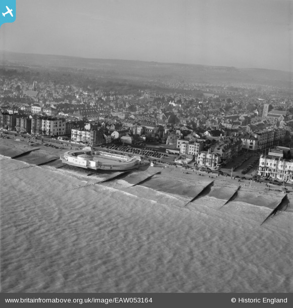
EAW053164 ENGLAND (1954). The Bandstand and the town, Worthing, from the south-east, 1954
© Copyright OpenStreetMap contributors and licensed by the OpenStreetMap Foundation. 2026. Cartography is licensed as CC BY-SA.
Nearby Images (28)
EAW053164

EAW022245
 and the town, Worthing, from the south, 1949")
EPW018752

EPW000725

EPW039493

EAW022748

EAW053165

EPW011532

EPW017743

EPW045567

EPW042999

EPW017741

EPW000761

EPW039496

EPW017739

EPW054071

EPW000749

EAW022244

EPW000753

EAW022745

EPW000719

EAW022242

EPW011535

EPW011524

EPW042995

EAW053163

EPW042998

EPW017740

Details
| Title | [EAW053164] The Bandstand and the town, Worthing, from the south-east, 1954 |
| Reference | EAW053164 |
| Date | 20-February-1954 |
| Link | |
| Place name | WORTHING |
| Parish | |
| District | |
| Country | ENGLAND |
| Easting / Northing | 514805, 102267 |
| Longitude / Latitude | -0.37040776893574, 50.808003527476 |
| National Grid Reference | TQ148023 |
Pins
Be the first to add a comment to this image!
User Comment Contributions

Worthing Lido and Pier |

Alan McFaden |
Sunday 2nd of November 2014 10:10:12 AM |
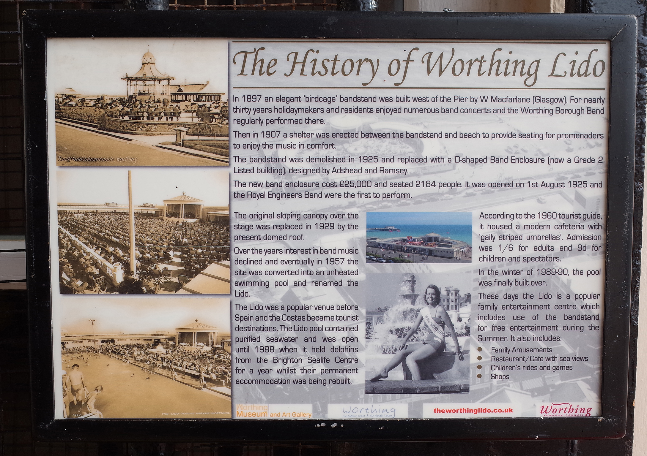
Worthing Bandstand history posted in Worthing Lido |
Alan McFaden |
Sunday 2nd of November 2014 10:09:17 AM |