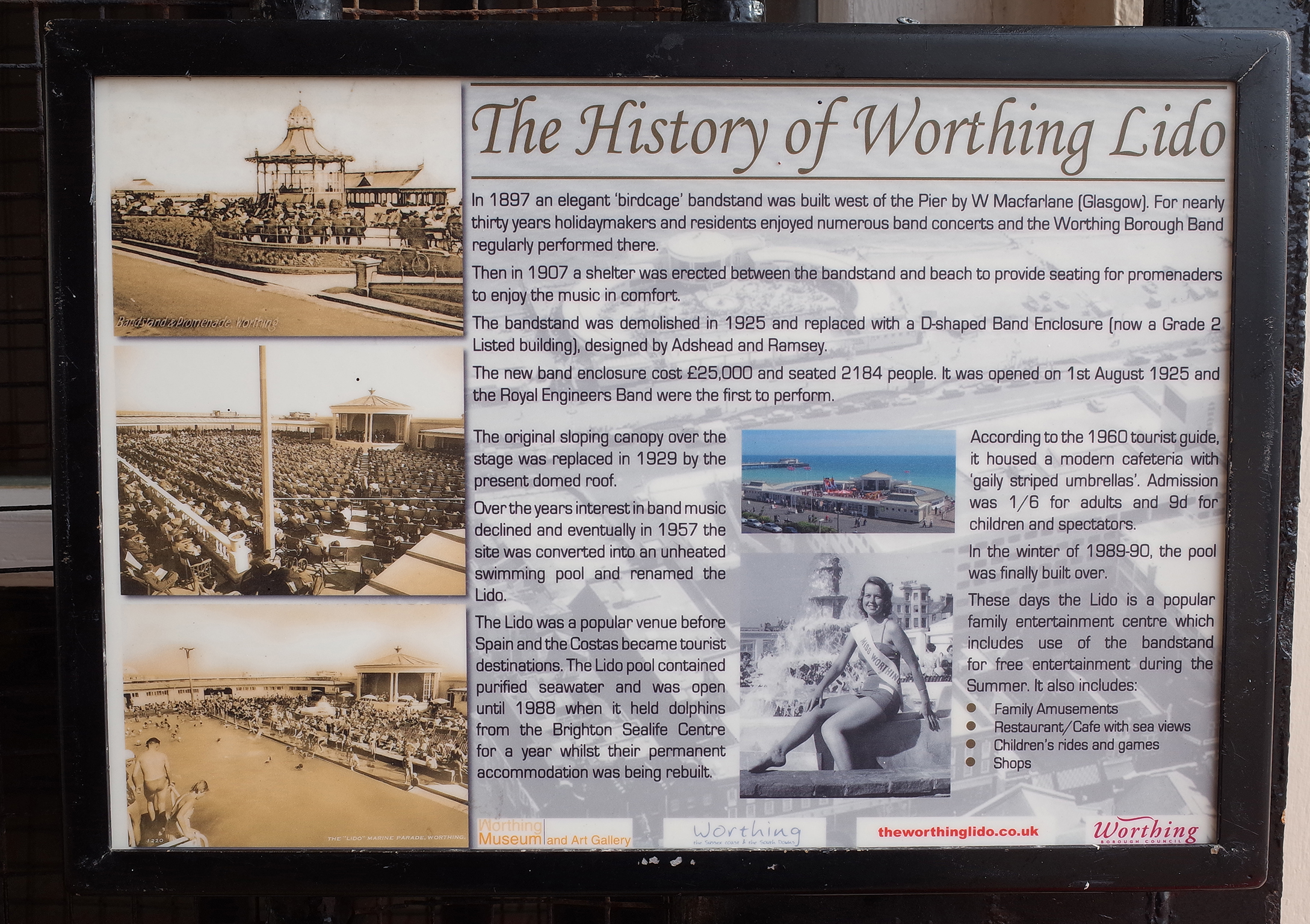
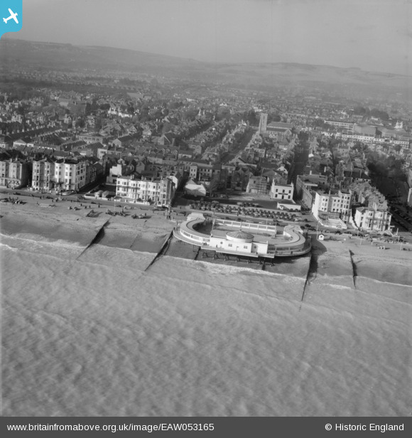
EAW053165 ENGLAND (1954). The Bandstand and the town, Worthing, from the south 1954
© Copyright OpenStreetMap contributors and licensed by the OpenStreetMap Foundation. 2026. Cartography is licensed as CC BY-SA.
Nearby Images (19)
Details
| Title | [EAW053165] The Bandstand and the town, Worthing, from the south 1954 |
| Reference | EAW053165 |
| Date | 20-February-1954 |
| Link | |
| Place name | WORTHING |
| Parish | |
| District | |
| Country | ENGLAND |
| Easting / Northing | 514742, 102250 |
| Longitude / Latitude | -0.3713069478843, 50.807863183082 |
| National Grid Reference | TQ147023 |
Pins
Be the first to add a comment to this image!
User Comment Contributions

Worthing Lido and Pier |

Alan McFaden |
Sunday 2nd of November 2014 10:06:57 AM |

Worthing Bandstand history on Worthing Lido |

Alan McFaden |
Sunday 2nd of November 2014 10:05:57 AM |


![[EAW053165] The Bandstand and the town, Worthing, from the south 1954](http://britainfromabove.org.uk/sites/all/libraries/aerofilms-images/public/100x100/EAW/053/EAW053165.jpg)
![[EPW017743] The bandstand and seafront, Worthing, from the south, 1927](http://britainfromabove.org.uk/sites/all/libraries/aerofilms-images/public/100x100/EPW/017/EPW017743.jpg)
![[EPW042999] The bandstand and Marine Parade, Worthing, from the south, 1933](http://britainfromabove.org.uk/sites/all/libraries/aerofilms-images/public/100x100/EPW/042/EPW042999.jpg)
![[EAW053164] The Bandstand and the town, Worthing, from the south-east, 1954](http://britainfromabove.org.uk/sites/all/libraries/aerofilms-images/public/100x100/EAW/053/EAW053164.jpg)
![[EPW039493] The Marine Parade Band Stand, the Pier Pavilion and the seafront, Worthing, 1932](http://britainfromabove.org.uk/sites/all/libraries/aerofilms-images/public/100x100/EPW/039/EPW039493.jpg)
![[EAW022748] The bandstand and seafront looking towards East Worthing, Worthing, from the south-west, 1949](http://britainfromabove.org.uk/sites/all/libraries/aerofilms-images/public/100x100/EAW/022/EAW022748.jpg)
![[EPW045567] The seafront and town, Worthing, from the south-west, 1934. This image has been produced from a damaged negative.](http://britainfromabove.org.uk/sites/all/libraries/aerofilms-images/public/100x100/EPW/045/EPW045567.jpg)
![[EAW022245] The Bandstand (The Lido) and the town, Worthing, from the south, 1949](http://britainfromabove.org.uk/sites/all/libraries/aerofilms-images/public/100x100/EAW/022/EAW022245.jpg)
![[EPW000761] Worthing, from the south-west, 1920](http://britainfromabove.org.uk/sites/all/libraries/aerofilms-images/public/100x100/EPW/000/EPW000761.jpg)
![[EPW018752] The pier, bandstand and town, Worthing, 1927](http://britainfromabove.org.uk/sites/all/libraries/aerofilms-images/public/100x100/EPW/018/EPW018752.jpg)
![[EPW000725] The Pier, Worthing, 1920](http://britainfromabove.org.uk/sites/all/libraries/aerofilms-images/public/100x100/EPW/000/EPW000725.jpg)
![[EPW039496] Marine Parade, the Pier Pavilion and the town, Worthing, 1932. This image has been affected by flare.](http://britainfromabove.org.uk/sites/all/libraries/aerofilms-images/public/100x100/EPW/039/EPW039496.jpg)
![[EPW011532] Marine Parade, Worthing, 1924](http://britainfromabove.org.uk/sites/all/libraries/aerofilms-images/public/100x100/EPW/011/EPW011532.jpg)
![[EPW017741] The pier pavilion and seafront, Worthing, 1927](http://britainfromabove.org.uk/sites/all/libraries/aerofilms-images/public/100x100/EPW/017/EPW017741.jpg)
![[EPW000749] The Pier, Worthing, from the south-west, 1920](http://britainfromabove.org.uk/sites/all/libraries/aerofilms-images/public/100x100/EPW/000/EPW000749.jpg)
![[EPW017739] The pier pavilion and seafront, Worthing, 1927](http://britainfromabove.org.uk/sites/all/libraries/aerofilms-images/public/100x100/EPW/017/EPW017739.jpg)
![[EPW054071] The Pier Pavilion and the town, Worthing, from the south-east, 1937](http://britainfromabove.org.uk/sites/all/libraries/aerofilms-images/public/100x100/EPW/054/EPW054071.jpg)
![[EAW022244] The Pier and the town, Worthing, from the south, 1949](http://britainfromabove.org.uk/sites/all/libraries/aerofilms-images/public/100x100/EAW/022/EAW022244.jpg)
![[EPW000719] South Street and the pier, Worthing, 1920. This image has been produced from a copy negative.](http://britainfromabove.org.uk/sites/all/libraries/aerofilms-images/public/100x100/EPW/000/EPW000719.jpg)