
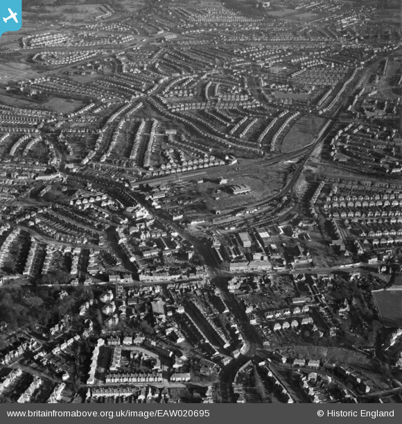
EAW020695 ENGLAND (1948). Central Edgware, Edgware, 1948
© Copyright OpenStreetMap contributors and licensed by the OpenStreetMap Foundation. 2026. Cartography is licensed as CC BY-SA.
Nearby Images (32)
EAW020695

EPW034554

EPW031556

EPW009603

EPW009341

EPW034614

EPW009342

EPW015982

EPW016514

EPW031551

EPW009343

EPW016516

EAW048861

EPW009374

EPW015770

EPW009376

EPW034613

EPW005282

EPW034620

EPW031554

EPW031553

EPW016513

EPW034615

EPW005277

EPW009373

EPW034618

EPW005281

EPW034610

EAW020694

EPW016512

EPW034612

EAW020693

Details
| Title | [EAW020695] Central Edgware, Edgware, 1948 |
| Reference | EAW020695 |
| Date | 17-December-1948 |
| Link | |
| Place name | EDGWARE |
| Parish | |
| District | |
| Country | ENGLAND |
| Easting / Northing | 519508, 191794 |
| Longitude / Latitude | -0.27384720377417, 51.611805047705 |
| National Grid Reference | TQ195918 |
Pins

NobodyInteresting |
Sunday 7th of April 2024 02:29:58 AM | |

Class31 |
Wednesday 30th of April 2014 09:38:23 AM | |
|
NthLondonBoy |
Sunday 22nd of December 2013 08:05:32 PM | |
|
NthLondonBoy |
Sunday 22nd of December 2013 08:04:05 PM | |
|
NthLondonBoy |
Sunday 22nd of December 2013 08:03:20 PM | |
|
NthLondonBoy |
Sunday 22nd of December 2013 08:01:46 PM | |
The story goes that the Ritz was built on marshy ground. Consequently, for the first couple of years the organ pit would flood, the water draining off as it was raised up. |
colsouth111 |
Wednesday 29th of January 2014 02:34:32 PM |

User Comment Contributions
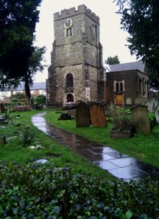
The Parish Church of St. Margaret of Antioch 18/02/2014 |
Class31 |
Friday 21st of February 2014 12:30:35 PM |