
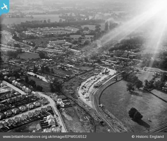
EPW016512 ENGLAND (1926). The railway station and environs, Edgware, 1926
© Copyright OpenStreetMap contributors and licensed by the OpenStreetMap Foundation. 2026. Cartography is licensed as CC BY-SA.
Nearby Images (18)
EPW016512

EAW020692

EPW005277

EAW020693

EPW005281

EPW015982

EPW005282

EPW034622

EPW031556

EPW034621

EAW020695

EPW015987

EPW034546

EPW009603

EPW016516

EPW034554

EPW009341

EPW031551

Details
| Title | [EPW016512] The railway station and environs, Edgware, 1926 |
| Reference | EPW016512 |
| Date | 25-August-1926 |
| Link | |
| Place name | EDGWARE |
| Parish | |
| District | |
| Country | ENGLAND |
| Easting / Northing | 519330, 191655 |
| Longitude / Latitude | -0.27646428033869, 51.61059344299 |
| National Grid Reference | TQ193917 |
Pins

Drdub |
Sunday 13th of June 2021 05:03:59 PM | |
|
johno |
Wednesday 10th of March 2021 11:06:20 PM | |
|
johno |
Tuesday 16th of February 2021 06:52:31 PM | |
|
NthLondonBoy |
Tuesday 24th of March 2015 05:03:19 PM | |
|
French47 |
Saturday 28th of June 2014 05:41:36 PM | |
|
snapper31 |
Tuesday 21st of May 2013 04:23:42 PM | |
|
snapper31 |
Monday 7th of January 2013 03:06:04 PM | |
|
MB |
Thursday 6th of September 2012 10:58:51 PM | |
|
MB |
Thursday 6th of September 2012 10:55:11 PM | |
|
MB |
Thursday 6th of September 2012 10:54:39 PM | |
|
MB |
Thursday 6th of September 2012 10:54:02 PM |
User Comment Contributions
A very rare picture of the original Edgware Station and Goods Yard. This line was part of the LNER route which extended to Mill Hill East, via an intermediate station at The Hale. It passed under the LMS main line at what would now be Mill Hill Broadway station. The bridge is still there by Lyndhurst Gardens but was completly bricked up when they built the M1. This line would have become part of the abandoned Northern Heights extension through to Bushey. |
gazzavc |
Tuesday 26th of June 2012 04:25:48 AM |