
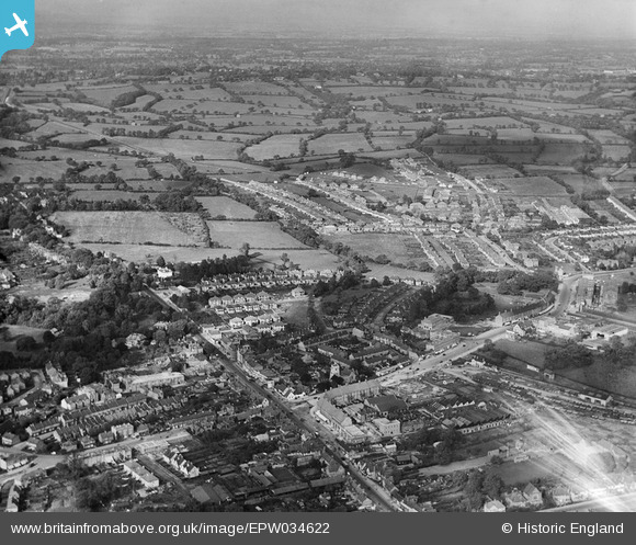
EPW034622 ENGLAND (1930). Housing development to the north of the old village, Edgware, from the south, 1930
© Copyright OpenStreetMap contributors and licensed by the OpenStreetMap Foundation. 2026. Cartography is licensed as CC BY-SA.
Nearby Images (18)
EPW034622

EPW034621

EAW020692

EPW015987

EPW016512

EPW049509

EPW034612

EAW027667
 in flight over the Broadfields Avenue area, Edgware, from the south-west, 1949")
EAW020693

EPW005277

EPW016516

EPW015982

EPW009603

EPW005281

EAW048861

EPW034623

EPW015983

EPW009376

Details
| Title | [EPW034622] Housing development to the north of the old village, Edgware, from the south, 1930 |
| Reference | EPW034622 |
| Date | 16-October-1930 |
| Link | |
| Place name | EDGWARE |
| Parish | |
| District | |
| Country | ENGLAND |
| Easting / Northing | 519221, 191768 |
| Longitude / Latitude | -0.27799940849501, 51.611632214002 |
| National Grid Reference | TQ192918 |


