
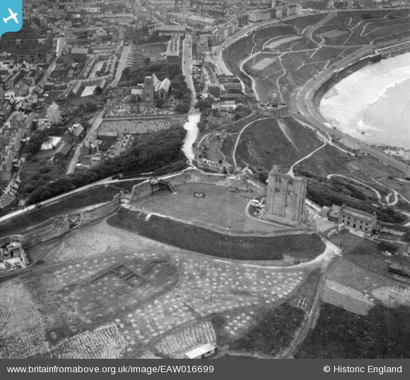
EAW016699 ENGLAND (1948). Scarborough Castle, Scarborough, 1948
© Copyright OpenStreetMap contributors and licensed by the OpenStreetMap Foundation. 2026. Cartography is licensed as CC BY-SA.
Nearby Images (15)
EAW016699

EAW016695

EAW005719

EAW016696

EPW029093

EAW005718

EAW007949

EAW005720

EAW005722

EAW005716

EAW005717

EAW005721

EAW007950

EAW016697

EAW016698

Details
| Title | [EAW016699] Scarborough Castle, Scarborough, 1948 |
| Reference | EAW016699 |
| Date | 23-June-1948 |
| Link | |
| Place name | SCARBOROUGH |
| Parish | |
| District | |
| Country | ENGLAND |
| Easting / Northing | 504914, 489145 |
| Longitude / Latitude | -0.38814133914519, 54.286993157709 |
| National Grid Reference | TA049891 |
Pins
Be the first to add a comment to this image!
User Comment Contributions
Scarborough Castle |

Robert - Cumbria |
Sunday 2nd of February 2014 09:32:49 AM |