
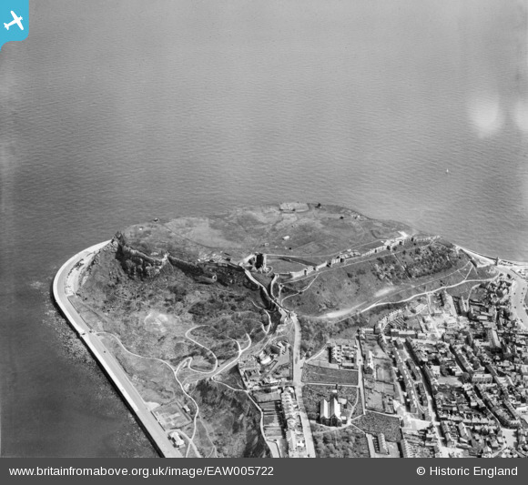
EAW005722 ENGLAND (1947). Scarborough Castle, Scarborough, 1947
© Copyright OpenStreetMap contributors and licensed by the OpenStreetMap Foundation. 2026. Cartography is licensed as CC BY-SA.
Nearby Images (15)
EAW005722

EAW005721

EAW005717

EAW005719

EAW005718

EAW005720

EPW029093

EAW016697

EAW005716

EAW007949

EAW016699

EAW016695

EAW016696

EAW007950

EAW016698

Details
| Title | [EAW005722] Scarborough Castle, Scarborough, 1947 |
| Reference | EAW005722 |
| Date | 15-May-1947 |
| Link | |
| Place name | SCARBOROUGH |
| Parish | |
| District | |
| Country | ENGLAND |
| Easting / Northing | 505020, 489183 |
| Longitude / Latitude | -0.38650016298698, 54.287312805808 |
| National Grid Reference | TA050892 |
Pins

User Comment Contributions
RAF HDU and another similar but smaller structure |

JMB |
Tuesday 14th of April 2015 11:27:10 AM |