
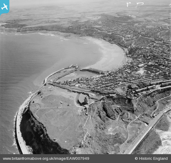
EAW007949 ENGLAND (1947). The castle and South Bay, Scarborough, from the north, 1947
© Copyright OpenStreetMap contributors and licensed by the OpenStreetMap Foundation. 2026. Cartography is licensed as CC BY-SA.
Nearby Images (15)
EAW007949

EAW016696

EAW005720

EAW016695

EAW016699

EAW005719

EAW005722

EAW007950

EAW005721

EAW005718

EPW029093

EAW005717

EAW016697

EAW005716

EAW016698

Details
| Title | [EAW007949] The castle and South Bay, Scarborough, from the north, 1947 |
| Reference | EAW007949 |
| Date | 26-June-1947 |
| Link | |
| Place name | SCARBOROUGH |
| Parish | |
| District | |
| Country | ENGLAND |
| Easting / Northing | 504929, 489236 |
| Longitude / Latitude | -0.38787905083668, 54.287807687686 |
| National Grid Reference | TA049892 |
Pins

redmist |
Thursday 12th of September 2019 08:18:34 PM | |
|
redmist |
Thursday 12th of September 2019 08:16:32 PM | |

JMB |
Wednesday 7th of June 2017 06:43:56 PM | |
|
JMB |
Wednesday 7th of June 2017 06:42:21 PM | |
|
JMB |
Wednesday 7th of June 2017 06:15:47 PM | |

Alan McFaden |
Wednesday 15th of January 2014 06:36:19 PM | |
|
Alan McFaden |
Wednesday 15th of January 2014 06:35:46 PM | |
|
Alan McFaden |
Wednesday 15th of January 2014 06:35:16 PM | |
|
Alan McFaden |
Wednesday 15th of January 2014 06:34:40 PM | |
|
Alan McFaden |
Wednesday 15th of January 2014 06:34:11 PM |


