
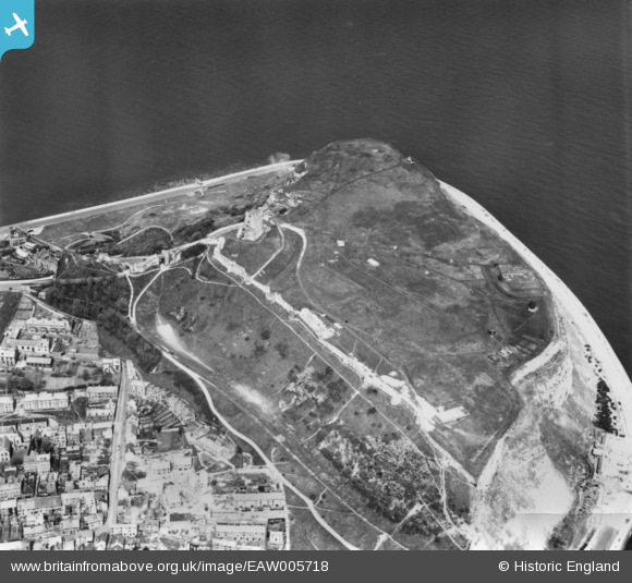
EAW005718 ENGLAND (1947). Scarborough Castle, Scarborough, 1947. This image has been produced from a print.
© Copyright OpenStreetMap contributors and licensed by the OpenStreetMap Foundation. 2026. Cartography is licensed as CC BY-SA.
Nearby Images (16)
EAW005718

EPW029093

EAW005719

EAW005717

EAW005716

EAW005721

EAW005722

EAW016697

EAW016699

EAW005720

EAW016695

EAW007949

EAW016696

EAW007950

EAW016698

EPW038935

Details
| Title | [EAW005718] Scarborough Castle, Scarborough, 1947. This image has been produced from a print. |
| Reference | EAW005718 |
| Date | 15-May-1947 |
| Link | |
| Place name | SCARBOROUGH |
| Parish | |
| District | |
| Country | ENGLAND |
| Easting / Northing | 504999, 489133 |
| Longitude / Latitude | -0.38684021803143, 54.286867884985 |
| National Grid Reference | TA050891 |
Pins
Be the first to add a comment to this image!