
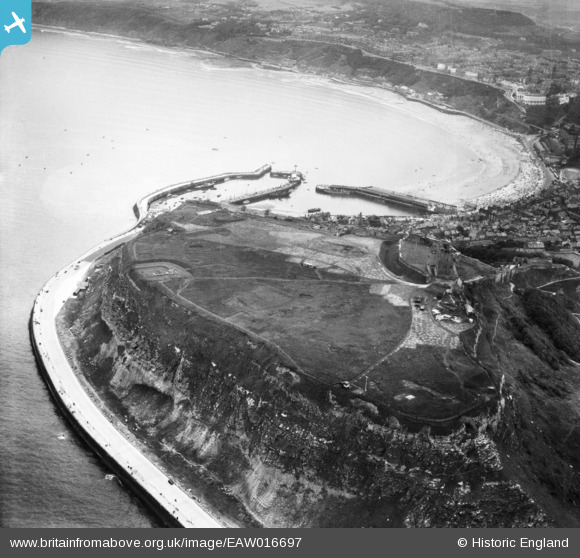
EAW016697 ENGLAND (1948). Castle Hill and South Bay, Scarborough, 1948
© Copyright OpenStreetMap contributors and licensed by the OpenStreetMap Foundation. 2026. Cartography is licensed as CC BY-SA.
Nearby Images (16)
EAW016697

EAW005717

EAW005721

EAW005718

EPW029093

EAW005716

EAW005722

EAW005719

EAW005720

EAW016699

EAW016695

EAW007949

EAW016696

EPW038935

EAW016698

EAW007950

Details
| Title | [EAW016697] Castle Hill and South Bay, Scarborough, 1948 |
| Reference | EAW016697 |
| Date | 23-June-1948 |
| Link | |
| Place name | SCARBOROUGH |
| Parish | |
| District | |
| Country | ENGLAND |
| Easting / Northing | 505054, 489125 |
| Longitude / Latitude | -0.38599840315831, 54.286784704659 |
| National Grid Reference | TA051891 |
Pins

redmist |
Thursday 12th of September 2019 08:01:25 PM | |

Alan McFaden |
Thursday 9th of January 2014 11:25:24 AM | |
|
Alan McFaden |
Thursday 9th of January 2014 11:24:46 AM | |
|
Alan McFaden |
Thursday 9th of January 2014 11:23:08 AM |


