
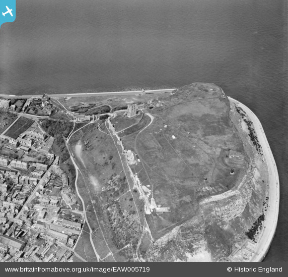
EAW005719 ENGLAND (1947). Scarborough Castle, Scarborough, 1947
© Copyright OpenStreetMap contributors and licensed by the OpenStreetMap Foundation. 2026. Cartography is licensed as CC BY-SA.
Nearby Images (15)
EAW005719

EAW005718

EPW029093

EAW005717

EAW005722

EAW005721

EAW005716

EAW016697

EAW016699

EAW005720

EAW016695

EAW007949

EAW016696

EAW007950

EAW016698

Details
| Title | [EAW005719] Scarborough Castle, Scarborough, 1947 |
| Reference | EAW005719 |
| Date | 15-May-1947 |
| Link | |
| Place name | SCARBOROUGH |
| Parish | |
| District | |
| Country | ENGLAND |
| Easting / Northing | 504986, 489147 |
| Longitude / Latitude | -0.38703494129042, 54.286996341677 |
| National Grid Reference | TA050891 |
Pins

redmist |
Friday 13th of September 2019 09:40:35 AM | |
|
redmist |
Friday 13th of September 2019 09:39:34 AM | |
|
The Laird |
Sunday 22nd of March 2015 12:02:07 PM |