
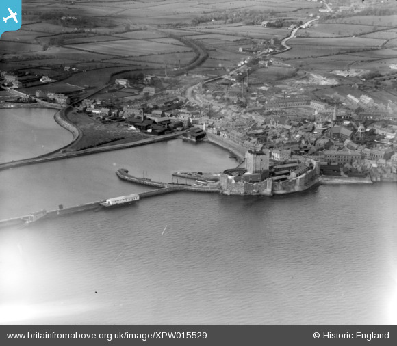
XPW015529 NORTHERN IRELAND (1926). View of Harbour, Carrickfergus, Carrickfergus, Northern Ireland, 1926. Oblique aerial photograph taken facing West.
© Hawlfraint cyfranwyr OpenStreetMap a thrwyddedwyd gan yr OpenStreetMap Foundation. 2026. Trwyddedir y gartograffeg fel CC BY-SA.
Delweddau cyfagos (6)
XPW015529

XAW019159

XPW028711

XPW028714

XPW015530

XPW028709

Manylion
| Pennawd | [XPW015529] View of Harbour, Carrickfergus, Carrickfergus, Northern Ireland, 1926. Oblique aerial photograph taken facing West. |
| Cyfeirnod | XPW015529 |
| Dyddiad | 1926 |
| Dolen | |
| Enw lle | CARRICKFERGUS |
| Plwyf | NORTHERN IRELAND |
| Ardal | |
| Gwlad | NORTHERN IRELAND |
| Dwyreiniad / Gogleddiad | 154751, 542027 |
| Hydred / Lledred | -5.809127, 54.713304 |
| Cyfeirnod Grid Cenedlaethol |
Pinnau

Big Al |
Saturday 11th of January 2025 10:42:04 AM | |
|
manalive45 |
Tuesday 1st of December 2015 04:44:38 PM |
Cyfraniadau Grŵp

1926 |
Valerie |
Monday 13th of October 2014 11:01:28 PM |