
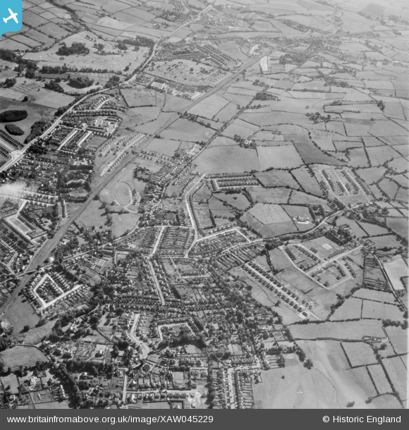
XAW045229 NORTHERN IRELAND (1952). General View, Gilnahirk, Castlereagh, Northern Ireland, 1952. Oblique aerial photograph taken facing North/East.
© Hawlfraint cyfranwyr OpenStreetMap a thrwyddedwyd gan yr OpenStreetMap Foundation. 2026. Trwyddedir y gartograffeg fel CC BY-SA.
Delweddau cyfagos (3)
XAW045229

XAW045228

XAW045235

Manylion
| Pennawd | [XAW045229] General View, Gilnahirk, Castlereagh, Northern Ireland, 1952. Oblique aerial photograph taken facing North/East. |
| Cyfeirnod | XAW045229 |
| Dyddiad | 1952 |
| Dolen | |
| Enw lle | GILNAHIRK |
| Plwyf | NORTHERN IRELAND |
| Ardal | |
| Gwlad | NORTHERN IRELAND |
| Dwyreiniad / Gogleddiad | 152162, 528131 |
| Hydred / Lledred | -5.837449, 54.587437 |
| Cyfeirnod Grid Cenedlaethol |
Pinnau

IntrepidExplorer82 |
Wednesday 23rd of September 2020 10:19:28 PM | |
|
Richard Craig |
Friday 4th of October 2019 01:02:38 PM | |
|
Buzby |
Friday 31st of October 2014 01:42:56 PM |