
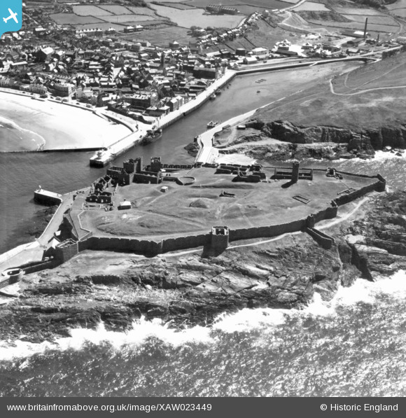
XAW023449 ISLE OF MAN (1949). General View, Peel, Isle of Man, Isle of Man, 1949. Oblique aerial photograph taken facing South.
© Hawlfraint cyfranwyr OpenStreetMap a thrwyddedwyd gan yr OpenStreetMap Foundation. 2026. Trwyddedir y gartograffeg fel CC BY-SA.
Delweddau cyfagos (4)
XAW023449

XAW023447

XAW023450

XAW023451

Manylion
| Pennawd | [XAW023449] General View, Peel, Isle of Man, Isle of Man, 1949. Oblique aerial photograph taken facing South. |
| Cyfeirnod | XAW023449 |
| Dyddiad | 26-May-1949 |
| Dolen | |
| Enw lle | PEEL |
| Plwyf | ISLE OF MAN |
| Ardal | |
| Gwlad | ISLE OF MAN |
| Dwyreiniad / Gogleddiad | 224197, 484453 |
| Hydred / Lledred | -4.69831, 54.225547 |
| Cyfeirnod Grid Cenedlaethol |
Pinnau
Cyfraniadau Grŵp
Peel Castle in the foreground. |

Andy Johnson |
Monday 8th of September 2014 02:53:06 PM |