
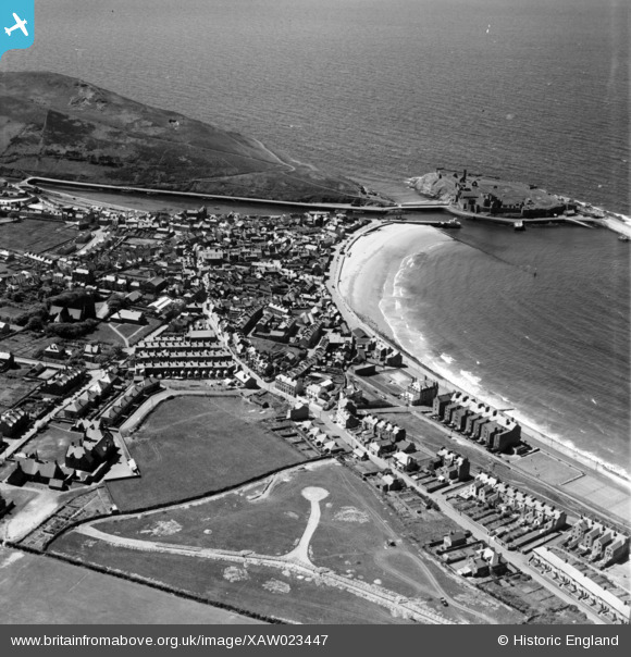
XAW023447 ISLE OF MAN (1949). General View, Peel, Isle of Man, Isle of Man, 1949. Oblique aerial photograph taken facing West.
© Hawlfraint cyfranwyr OpenStreetMap a thrwyddedwyd gan yr OpenStreetMap Foundation. 2026. Trwyddedir y gartograffeg fel CC BY-SA.
Delweddau cyfagos (2)
XAW023447

XAW023449

Manylion
| Pennawd | [XAW023447] General View, Peel, Isle of Man, Isle of Man, 1949. Oblique aerial photograph taken facing West. |
| Cyfeirnod | XAW023447 |
| Dyddiad | 26-May-1949 |
| Dolen | |
| Enw lle | PEEL |
| Plwyf | ISLE OF MAN |
| Ardal | |
| Gwlad | ISLE OF MAN |
| Dwyreiniad / Gogleddiad | 224146, 484309 |
| Hydred / Lledred | -4.699006, 54.224236 |
| Cyfeirnod Grid Cenedlaethol |
Pinnau

Arthur |
Wednesday 16th of March 2016 06:01:14 PM | |
|
Arthur |
Wednesday 16th of March 2016 05:59:02 PM | |
|
Arthur |
Wednesday 16th of March 2016 09:36:28 AM | |
|
Arthur |
Wednesday 16th of March 2016 09:35:58 AM | |
|
Arthur |
Wednesday 16th of March 2016 09:34:32 AM | |
|
Arthur |
Wednesday 16th of March 2016 09:33:50 AM | |
|
Arthur |
Wednesday 16th of March 2016 09:31:06 AM | |
|
Arthur |
Wednesday 16th of March 2016 09:29:26 AM | |
|
Arthur |
Wednesday 16th of March 2016 09:26:37 AM | |
|
Arthur |
Wednesday 16th of March 2016 09:25:44 AM |