
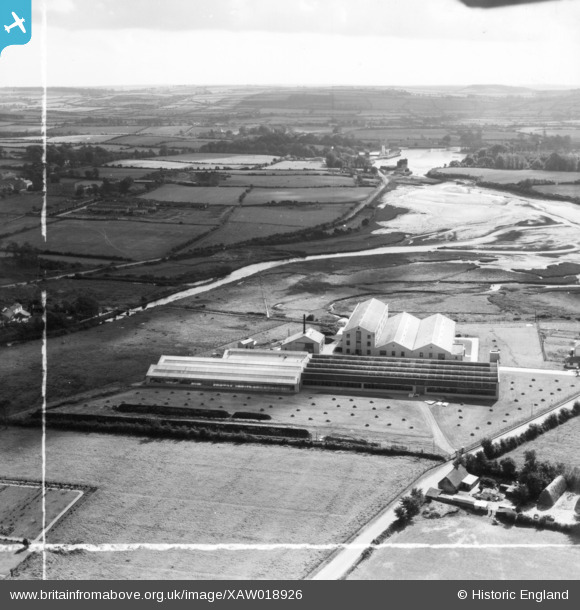
XAW018926 IRELAND (1948). The Midleton Worsted Mills, Midleton, Cork, Ireland, 1948. Oblique aerial photograph taken facing South. This image was marked by Aerofilms Ltd for photo editing.
© Hawlfraint cyfranwyr OpenStreetMap a thrwyddedwyd gan yr OpenStreetMap Foundation. 2026. Trwyddedir y gartograffeg fel CC BY-SA.
Delweddau cyfagos (11)
XAW018926

XAW018921

XAW018925

XAW018930

XAW018919

XAW018922

XAW018923

XAW018931

XAW018920

XAW018918

XAW018924

Manylion
| Pennawd | [XAW018926] The Midleton Worsted Mills, Midleton, Cork, Ireland, 1948. Oblique aerial photograph taken facing South. This image was marked by Aerofilms Ltd for photo editing. |
| Cyfeirnod | XAW018926 |
| Dyddiad | 24-February-1948 |
| Dolen | |
| Enw lle | MIDLETON |
| Plwyf | IRELAND |
| Ardal | |
| Gwlad | IRELAND |
| Dwyreiniad / Gogleddiad | -24732, 241876 |
| Hydred / Lledred | -8.178976, 51.912871 |
| Cyfeirnod Grid Cenedlaethol |
Pinnau

powerpop |
Saturday 2nd of May 2015 05:44:11 PM |