
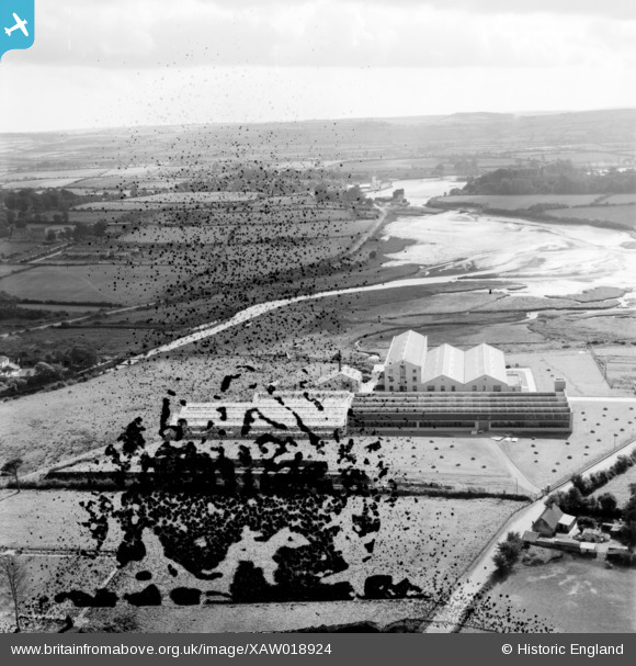
XAW018924 IRELAND (1948). The Midleton Worsted Mills, Main Building, Midleton, Cork, Ireland, 1948. Oblique aerial photograph taken facing South.
© Hawlfraint cyfranwyr OpenStreetMap a thrwyddedwyd gan yr OpenStreetMap Foundation. 2026. Trwyddedir y gartograffeg fel CC BY-SA.
Delweddau cyfagos (12)
XAW018924

XAW018918

XAW018920

XAW018931

XAW018923

XAW018922

XAW018925

XAW018919

XAW018921

XAW018930

XPW042390

XAW018926

Manylion
| Pennawd | [XAW018924] The Midleton Worsted Mills, Main Building, Midleton, Cork, Ireland, 1948. Oblique aerial photograph taken facing South. |
| Cyfeirnod | XAW018924 |
| Dyddiad | 24-September-1948 |
| Dolen | |
| Enw lle | MIDLETON |
| Plwyf | IRELAND |
| Ardal | |
| Gwlad | IRELAND |
| Dwyreiniad / Gogleddiad | -24641, 241722 |
| Hydred / Lledred | -8.17747, 51.911558 |
| Cyfeirnod Grid Cenedlaethol |
