
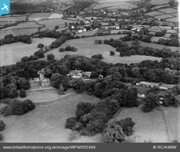
WPW055496 WALES (1937). View of Hean Castle and grounds, Saundersfoot, oblique aerial view. 5"x4" black and white glass plate negative.
© Hawlfraint cyfranwyr OpenStreetMap a thrwyddedwyd gan yr OpenStreetMap Foundation. 2026. Trwyddedir y gartograffeg fel CC BY-SA.
Delweddau cyfagos (5)
WPW055493

WPW055494

WPW055495

WPW055496

WPW055497

Manylion
| Pennawd | [WPW055496] View of Hean Castle and grounds, Saundersfoot, oblique aerial view. 5"x4" black and white glass plate negative. |
| Cyfeirnod | WPW055496 |
| Dyddiad | 22-September-1937 |
| Dolen | Coflein Archive Item 6370156 |
| Enw lle | |
| Plwyf | |
| Ardal | |
| Gwlad | WALES |
| Dwyreiniad / Gogleddiad | 213830, 205980 |
| Hydred / Lledred | -4.6956250999674, 51.721135023369 |
| Cyfeirnod Grid Cenedlaethol | SN138060 |
Pinnau
Byddwch y cyntaf i ychwanegu sylw at y ddelwedd hon!