
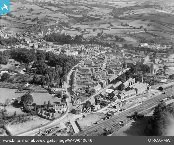
WPW040046 WALES (1932). General view of Newtown, oblique aerial view. 5"x4" black and white glass plate negative.
© Hawlfraint cyfranwyr OpenStreetMap a thrwyddedwyd gan yr OpenStreetMap Foundation. 2025. Trwyddedir y gartograffeg fel CC BY-SA.
Delweddau cyfagos (5)
WPW040044

WPW040045

WPW040046

WPW040047

WPW040048

Manylion
| Pennawd | [WPW040046] General view of Newtown, oblique aerial view. 5"x4" black and white glass plate negative. |
| Cyfeirnod | WPW040046 |
| Dyddiad | 1932 |
| Dolen | Coflein Archive Item 6369659 |
| Enw lle | |
| Plwyf | |
| Ardal | |
| Gwlad | WALES |
| Dwyreiniad / Gogleddiad | 310856, 291610 |
| Hydred / Lledred | -3.3137939736171, 52.514711565539 |
| Cyfeirnod Grid Cenedlaethol | SO109916 |
Pinnau

John Ellis |
Thursday 30th of January 2014 11:23:42 AM | |
|
John Ellis |
Thursday 30th of January 2014 11:21:07 AM | |
|
MB |
Friday 26th of April 2013 05:47:49 PM | |
|
MB |
Friday 26th of April 2013 05:46:56 PM | |
|
MB |
Friday 26th of April 2013 05:45:45 PM | |

Class31 |
Wednesday 31st of October 2012 05:09:20 PM | |
|
Class31 |
Wednesday 31st of October 2012 05:08:47 PM | |
|
Class31 |
Wednesday 31st of October 2012 05:08:27 PM | |
|
Class31 |
Wednesday 31st of October 2012 05:07:48 PM | |
|
Class31 |
Wednesday 31st of October 2012 05:07:24 PM |