
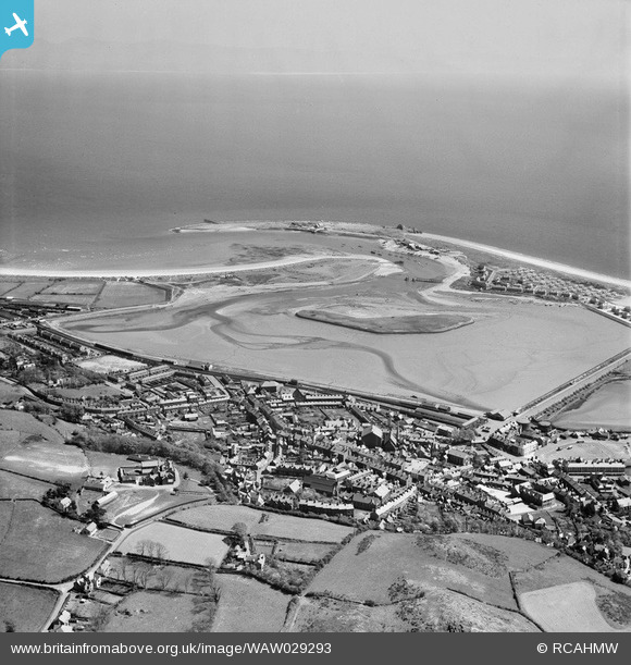
WAW029293 WALES (1950). General view of Pwllheli
© Hawlfraint cyfranwyr OpenStreetMap a thrwyddedwyd gan yr OpenStreetMap Foundation. 2026. Trwyddedir y gartograffeg fel CC BY-SA.
Delweddau cyfagos (13)
WAW029293

WAW029294

WAW029295

WAW029296

WPW045215

WPW045216

WPW045217

WPW045218

WPW045219

WPW045220
 near Pwllheli, oblique aerial view. 5\"x4\" black and white glass plate negative.")
WPW045221
 near Pwllheli, oblique aerial view. 5\"x4\" black and white glass plate negative.")
WPW045222
 near Pwllheli, oblique aerial view. 5\"x4\" black and white glass plate negative.")
WPW045223
 near Pwllheli, oblique aerial view. 5\"x4\" black and white glass plate negative.")
Manylion
| Pennawd | [WAW029293] General view of Pwllheli |
| Cyfeirnod | WAW029293 |
| Dyddiad | 1950 |
| Dolen | Coflein Archive Item 6414197 |
| Enw lle | |
| Plwyf | |
| Ardal | |
| Gwlad | WALES |
| Dwyreiniad / Gogleddiad | 237425, 335193 |
| Hydred / Lledred | -4.416750686082, 52.889254290467 |
| Cyfeirnod Grid Cenedlaethol | SH374352 |
Pinnau

pokchop |
Friday 13th of November 2020 07:14:53 PM | |
|
Ian Warburton |
Wednesday 31st of December 2014 06:08:58 PM |