
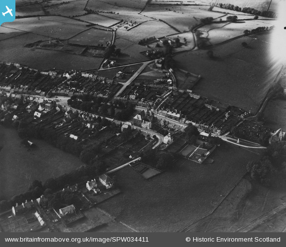
SPW034411 SCOTLAND (1930). Wigtown, general view, showing The Square and Harbour Road. An oblique aerial photograph taken facing north-west. This image has been produced from a print.
© Hawlfraint cyfranwyr OpenStreetMap a thrwyddedwyd gan yr OpenStreetMap Foundation. 2026. Trwyddedir y gartograffeg fel CC BY-SA.
Delweddau cyfagos (4)
SPW034411

SPW034408

SPW034410

SPW034409

Manylion
| Pennawd | [SPW034411] Wigtown, general view, showing The Square and Harbour Road. An oblique aerial photograph taken facing north-west. This image has been produced from a print. |
| Cyfeirnod | SPW034411 |
| Dyddiad | 1930 |
| Dolen | NRHE Collection item 1315499 |
| Enw lle | |
| Plwyf | WIGTOWN |
| Ardal | WIGTOWN |
| Gwlad | SCOTLAND |
| Dwyreiniad / Gogleddiad | 243425, 555374 |
| Hydred / Lledred | -4.4402002629998, 54.868505268208 |
| Cyfeirnod Grid Cenedlaethol | NX434554 |
Pinnau
Byddwch y cyntaf i ychwanegu sylw at y ddelwedd hon!