
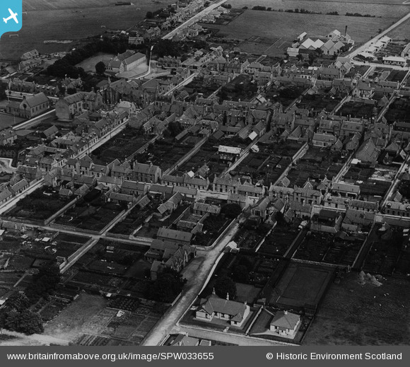
SPW033655 SCOTLAND (1930). Keith, general view, showing Land Street and Union Street. An oblique aerial photograph taken facing east. This image has been produced from a print.
© Hawlfraint cyfranwyr OpenStreetMap a thrwyddedwyd gan yr OpenStreetMap Foundation. 2026. Trwyddedir y gartograffeg fel CC BY-SA.
Delweddau cyfagos (8)
SPW033655

SPW033651

SAR023875

SAR023876

SAR023877

SAR025574

SPW033652

SPW033653

Manylion
| Pennawd | [SPW033655] Keith, general view, showing Land Street and Union Street. An oblique aerial photograph taken facing east. This image has been produced from a print. |
| Cyfeirnod | SPW033655 |
| Dyddiad | 1930 |
| Dolen | NRHE Collection item 1315488 |
| Enw lle | |
| Plwyf | KEITH |
| Ardal | MORAY |
| Gwlad | SCOTLAND |
| Dwyreiniad / Gogleddiad | 343102, 850567 |
| Hydred / Lledred | -2.95059360155, 57.541877824179 |
| Cyfeirnod Grid Cenedlaethol | NJ431506 |
Pinnau
Byddwch y cyntaf i ychwanegu sylw at y ddelwedd hon!