
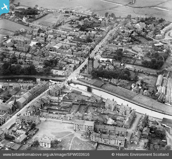
SPW033616 SCOTLAND (1930). Kirkintilloch, general view, showing St Mary's Parish Church, Cowgate and Forth and Clyde Canal. An oblique aerial photograph taken facing north-west.
© Hawlfraint cyfranwyr OpenStreetMap a thrwyddedwyd gan yr OpenStreetMap Foundation. 2026. Trwyddedir y gartograffeg fel CC BY-SA.
Delweddau cyfagos (7)
SPW033615

SPW033616

SPW056743

SPW033617

SPW056742

SPW033618

SPW033619

Manylion
| Pennawd | [SPW033616] Kirkintilloch, general view, showing St Mary's Parish Church, Cowgate and Forth and Clyde Canal. An oblique aerial photograph taken facing north-west. |
| Cyfeirnod | SPW033616 |
| Dyddiad | 1930 |
| Dolen | NRHE Collection item 1259371 |
| Enw lle | |
| Plwyf | KIRKINTILLOCH (STRATHKELVIN) |
| Ardal | STRATHKELVIN |
| Gwlad | SCOTLAND |
| Dwyreiniad / Gogleddiad | 265475, 673891 |
| Hydred / Lledred | -4.1539827082401, 55.939254822694 |
| Cyfeirnod Grid Cenedlaethol | NS655739 |
Pinnau
Byddwch y cyntaf i ychwanegu sylw at y ddelwedd hon!