
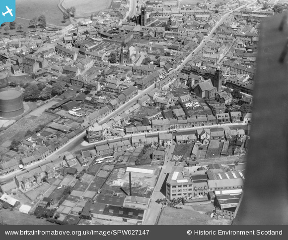
SPW027147 SCOTLAND (1929). Bathgate, general view, showing St David's Church and North Bridge Street. An oblique aerial photograph taken facing north-east.
© Hawlfraint cyfranwyr OpenStreetMap a thrwyddedwyd gan yr OpenStreetMap Foundation. 2026. Trwyddedir y gartograffeg fel CC BY-SA.
Delweddau cyfagos (6)
SPW027147

SPW027151

SPW027145

SPW027153

SPW027150

SPW027148

Manylion
| Pennawd | [SPW027147] Bathgate, general view, showing St David's Church and North Bridge Street. An oblique aerial photograph taken facing north-east. |
| Cyfeirnod | SPW027147 |
| Dyddiad | 1929 |
| Dolen | NRHE Collection item 1256722 |
| Enw lle | |
| Plwyf | BATHGATE |
| Ardal | WEST LOTHIAN |
| Gwlad | SCOTLAND |
| Dwyreiniad / Gogleddiad | 297350, 668870 |
| Hydred / Lledred | -3.6419722665464, 55.902018649728 |
| Cyfeirnod Grid Cenedlaethol | NS974689 |
Pinnau

MB |
Tuesday 25th of September 2012 10:05:33 AM | |
The area is not Glenmavis it is known as Belvedere/Balbardie |
ianh48 |
Sunday 30th of December 2012 05:07:42 PM |
|
MB |
Tuesday 25th of September 2012 10:03:53 AM | |
|
MB |
Tuesday 25th of September 2012 10:03:02 AM | |
|
MB |
Tuesday 25th of September 2012 10:02:40 AM | |
|
MB |
Tuesday 25th of September 2012 10:01:56 AM | |
|
MB |
Tuesday 25th of September 2012 10:01:33 AM | |
|
MB |
Tuesday 25th of September 2012 10:00:46 AM | |
|
MB |
Tuesday 25th of September 2012 10:00:18 AM |