
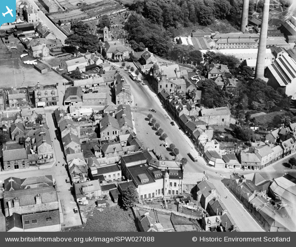
SPW027088 SCOTLAND (1929). Penicuik, general view, showing High Street and St Mungo's Church. An oblique aerial photograph taken facing east.
© Hawlfraint cyfranwyr OpenStreetMap a thrwyddedwyd gan yr OpenStreetMap Foundation. 2026. Trwyddedir y gartograffeg fel CC BY-SA.
Delweddau cyfagos (15)
SPW027088

SPW027087

SPW042191

SPW027089

SPW042190

SPW027095

SPW027096

SPW027097

SPW042192

SPW051113

SPW051114

SPW051115

SPW051116

SPW051117

SPW051119

Manylion
| Pennawd | [SPW027088] Penicuik, general view, showing High Street and St Mungo's Church. An oblique aerial photograph taken facing east. |
| Cyfeirnod | SPW027088 |
| Dyddiad | 1929 |
| Dolen | NRHE Collection item 1256607 |
| Enw lle | |
| Plwyf | PENICUIK (MIDLOTHIAN) |
| Ardal | MIDLOTHIAN |
| Gwlad | SCOTLAND |
| Dwyreiniad / Gogleddiad | 323594, 659914 |
| Hydred / Lledred | -3.219778982809, 55.826439682169 |
| Cyfeirnod Grid Cenedlaethol | NT236599 |
Pinnau
Byddwch y cyntaf i ychwanegu sylw at y ddelwedd hon!