
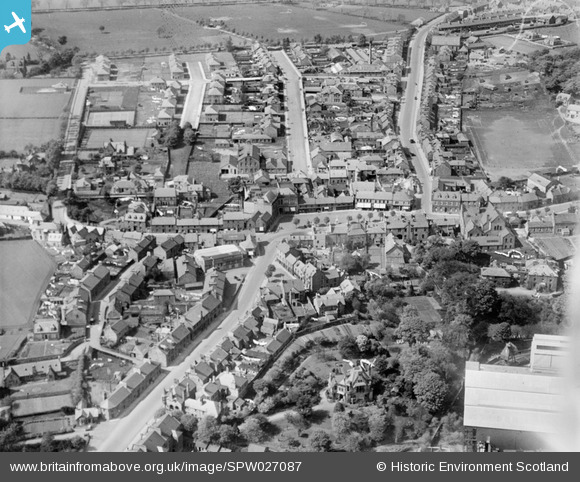
SPW027087 SCOTLAND (1929). Penicuik, general view, showing High Street, John Street and Woodslea. An oblique aerial photograph taken facing north.
© Hawlfraint cyfranwyr OpenStreetMap a thrwyddedwyd gan yr OpenStreetMap Foundation. 2026. Trwyddedir y gartograffeg fel CC BY-SA.
Delweddau cyfagos (5)
SPW027087

SPW027088

SPW042191

SPW027089

SPW042190

Manylion
| Pennawd | [SPW027087] Penicuik, general view, showing High Street, John Street and Woodslea. An oblique aerial photograph taken facing north. |
| Cyfeirnod | SPW027087 |
| Dyddiad | 1929 |
| Dolen | NRHE Collection item 1256606 |
| Enw lle | |
| Plwyf | PENICUIK (MIDLOTHIAN) |
| Ardal | MIDLOTHIAN |
| Gwlad | SCOTLAND |
| Dwyreiniad / Gogleddiad | 323535, 659890 |
| Hydred / Lledred | -3.2207138917231, 55.826214726056 |
| Cyfeirnod Grid Cenedlaethol | NT235599 |
